

Target 1
Plan and Manage all Areas To Reduce Biodiversity Loss
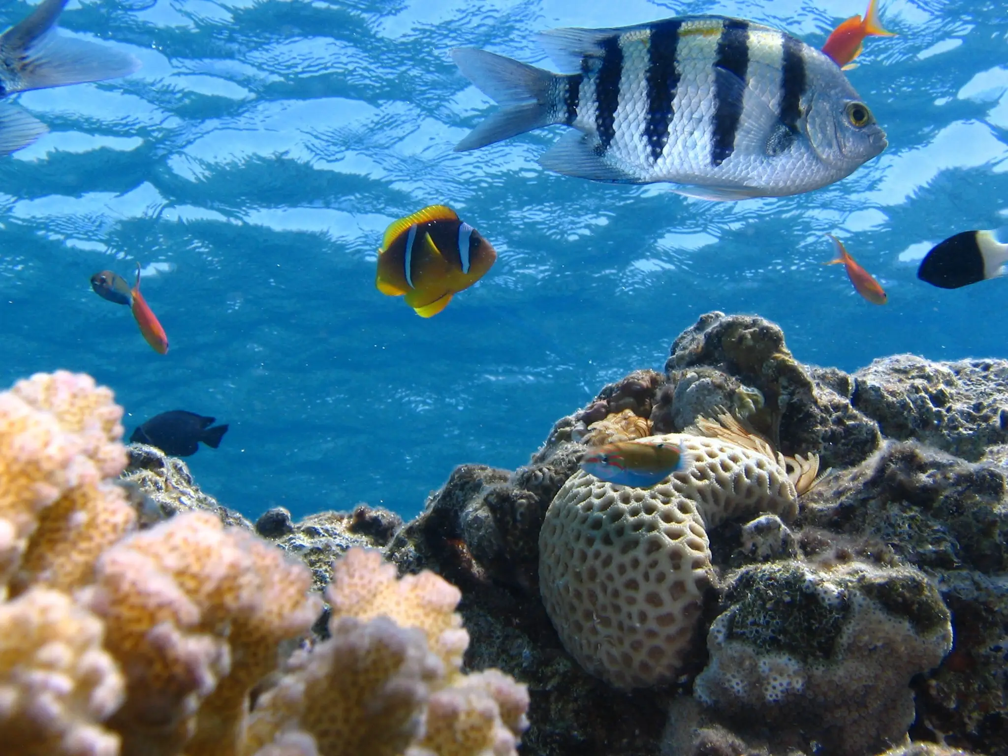
Ensure that all areas are under participatory integrated biodiversity inclusive spatial planning and/or effective management processes addressing land and sea use change, to bring the loss of areas of high biodiversity importance, including ecosystems of high ecological integrity, close to zero by 2030, while respecting the rights of indigenous peoples and local communities.

Ensure that all areas are under participatory integrated biodiversity inclusive spatial planning and/or effective management processes addressing land and sea use change, to bring the loss of areas of high biodiversity importance, including ecosystems of high ecological integrity, close to zero by 2030, while respecting the rights of indigenous peoples and local communities.
Rationale
GSAP
Spatial planning and legislative approaches at landscape, freshwater-scape and seascape scales are needed to maintain the integrity, functionality and connectivity of natural ecosystems and thus conserve the species that compose them. Such actions are particularly urgent in critical ecosystems under the highest pressure, such as coral reefs, tropical forests, peatlands, grasslands and savannas, freshwater, and coastal wetlands, and to ensure any further loss or degradation of remaining areas of high ecological integrity with their full species compositions.
GSAP SKILLS
Integrated spatial planning is a complex task involving the identification of priority ecosystems and setting representative targets, compilation of priority species lists, and a review of protected and conserved area networks. The process requires multi-sectoral coordination, and mainstreaming species conservation into government policy agendas including agriculture, mining, and infrastructure developments, including (i) the application of the mitigation hierarchy, with a primary focus on avoidance and (ii) Strategic Environmental Assessments and Environmental and Social Impact Assessments, both conducted according to international standards.
Compiling and integrating accurate spatial data are fundamental to this process, highlighting that Targets 1-4 are closely interlinked. In addition to ecosystem data, core datasets required include those on restoration (Target 2), site identification and protection (Target 3), and species recovery (Target 4).
GIS mapping skills and capacity are needed to produce the mapping. Detailed advice on undertaking systematic planning, including situations with low resources and capacity, is provided in SANBI’s Mapping Biodiversity Priorities.
Primary tools and resources
Connectivity 101: Ecological connectivity for people and planet
Connectivity 101 is a free, self-paced course provided by the Wildlife Connect Initiative – a partnership of the World Wide Fund for Nature (WWF), Center for Large Landscape Conservation (CLLC), IUCN World Commission on Protected Areas – Connectivity Conservation Specialist Group (CCSG), and Convention on Migratory Species (CMS), designed with UNDP’s Learning for Nature.
Connectivity 101 teaches the basics of ecological connectivity conservation. The course will present general and replicable best practices for connectivity conservation and context-sensitive case studies worldwide. The course will focus on an audience of conservation practitioners but will also be accessible to a general audience. A certificate will be awarded to those who complete the course. Currently, the course is offered in English. Translations to other UN languages may be available in the future.
Environmental and Social Impact Assessment (ESIA)
An ESIA is a statement about the likely impacts of a proposal and how the identified negative impacts can be mitigated and managed and how the positive impacts can be enhanced. The purpose of this review procedure is to ensure that the Initial Environmental Examination (IEE) and the Environmental Impact Assessment (EIA) reports provide adequate assessment and protection measures to manage environmental and social impacts. A systematic approach to review is needed to ensure that the environmental and social impact assessment reports comply with requirements, are consistent with standards of good practice, and provide good quality information to support decision making.
SANBI Mapping Biodiversity Priorities
This guide to practical, science-based approach to national biodiversity assessment and prioritisation has been produced by the South African National Biodiversity Institute (SANBI) and the UNEP World Conservation Monitoring Centre. The approach is based on the principles of Systematic Conservation Planning and is augmented by 10 operating principles. It sets out a practical, science-based approach to spatial biodiversity assessment and prioritisation and forms an excellent starting point to inform national spatial planning exercises, including detailed advice for low resource situations.
IUCN WCPA Diagnostic tool for transboundary conservation planners
This tool (i) supports the decision-making process when establishing and implementing transboundary conservation initiatives; (ii) minimizes the risks of the process; (iii) enables planners to assess the feasibility of design and implementation of transboundary conservation measures. Version 2.0 was released by IUCN’s World Commission on Protected Areas (WCPA) Transboundary Conservation Specialist Group in June 2020.
How to use
For further details and to access the tool:
IUCN Important Marine Mammals Areas (IMMAs)
Important Marine Mammal Areas (IMMAs) are defined as discrete portions of habitat important to marine mammal species that have the potential to be delineated and managed for conservation. IMMAs consist of areas that may merit place-based protection and/or monitoring. IMMAs are identified through an independent, expert process.
GEOBON Essential Biodiversity Variables (EBV)
The Group on Earth Biodiversity Observation Network (GEO BON) developed the concept of Essential Biodiversity Variables (EBVs) to advance the collection, sharing, and use of biodiversity information to aggregate, harmonise and interpret biodiversity observations collected by different methods such as in situ monitoring or remote sensing. EBVs can be visualised as biodiversity observations at one location over time, or in many locations, aggregated in a time series of maps. Essential variables to understand climate, biodiversity, and other environmental changes have already been developed (e.g. Essential Climate Variables, Essential Ocean Variables).
How to use
Details of the method, the EBVS already developed, and results are available at: https://geobon.org/ebvs/what-are-ebvs/
The World Database on Protected Areas (WDPA)
The WDPA is a comprehensive global database on terrestrial and marine protected areas and Other Effective Area-based Conservation Measures (OECMs). It is a joint project between the UN Environment Programme and IUCN, and is managed by the World Conservation Monitoring Centre (UNEP-WCMC). The WDPA is updated on a monthly basis and site data and maps are available through the Protected Planet platform. About 261,766 officially recognised protected areas are listed, covering over 15% of the of the earth’s land surface and 7.4% of the world’s oceans. Protected Planet contains interactive maps and has eight thematic areas. Every two years, UNEP-WCMC releases the Protected Planet Report on the status of the world’s protected areas and makes recommendations on how to meet international goals and targets.
How to use
- To access the Protected Planet website and explore the World Database on Protected Areas (WDPA), World Database on OECMs, Global Database on Protected Area Management Effectiveness (GD-PAME), and associated information: https://www.protectedplanet.net
- To contribute information on a site to the WDPA: https://www.protectedplanet.net/en/thematic-areas/wdpa?tab=WDPA
Important Shark and Ray Areas (ISRA)
ISRAs have been developed by the IUCN Species Survival Commission Shark Specialist Group to ensure that discrete portions of habitats critical to shark species are delineated and used in site-based conservation and management initiatives in global waters. ISRAs are identified through the application of four criteria, incorporating seven sub-criteria. The Criteria provide an objective framework for identifying areas crucial for the persistence of sharks and rays and, where required, their recovery.
Species Threat Abatement and Restoration (STAR) metric
The STAR metric assesses the potential of particular actions at a specific location to contribute to reduce species extinction risk / global targets for species. It measures the potential contribution of two kinds of action: threat abatement / reduction and habitat restoration using data on the distribution, threats, and extinction risk of threatened species contained in the IUCN Red List. It helps governments, the finance industry, investors, and companies to target their investments and activities to achieve conservation outcomes for threatened species. The STAR metric can be applied to any location. It is maintained under the authority of the IUCN Red List Committee.
IUCN Red List of Threatened Species
The IUCN Red List of Threatened Species (the Red List) is the globally recognised standard on assessing extinction risk. Red List assessments are used by the Convention on Biological Diversity, CITES, other inter-governmental agreements, national governments, and conservation planners. The Red List assigns species into one of 8 categories based on 5 criteria, all with quantitative thresholds. The three highest categories of threat – Critically Endangered, Endangered, Vulnerable – are collectively considered ‘Threatened’. The Red List process has been formalized to support objectivity and scientific rigour. Red List assessments are carried out by SSC Red List Authorities, Red List Partners, IUCN staff, and regional and national agencies. In addition, Red List assessments provide a compendium of information on species, (taxonomy, geographic range, population, habitat and ecology, threats, conservation actions). The Red List operates at global, regional, and national levels. Guidelines for application at national or regional levels have been developed and the National Red List Working Group provides additional support.
Red List Authorities have been established for all major taxonomic groups included on the IUCN Red List. In most cases, the RLA is a sub-group within an IUCN SSC Specialist Group responsible for the species, groups of species or species within a specific geographic area. There are some exceptions; for example, BirdLife International is the designated RLA for all birds.
The process is guided by Rules of Procedure, supported by guidelines on application of the Red List Categories and Criteria, the Species Information Service (SIS) data entry and management system, and certification for assessors and RL trainers. All these materials can be downloaded, free, from the Red List website. A free, online training course for Red List assessors, is available.
Species can be assessed for the Red List at global, regional, and national levels. Guidelines for the Regional (and national) Application of the Categories and Criteria have been developed and support for development of national Red Lists is available from the National Red List Working Group.
How to use
- To check the global Red List status of a species and access the supporting information, visit the species assessment page on the Red List website
- To download the Red List Categories and Criteria, Guidelines, Rules of Procedure, and Guidelines for Application at Regional Level go the Red List resources
- To initiate or to contribute to a global assessment, contact the Chair of the relevant IUCN SSC Specialist Group or Red List Authority, for birds, see BirdLife International
- For taxonomic groups not listed, contact the relevant IUCN SSC Conservation Committee: Marine, Invertebrate, Plant, Fungi, Freshwater, Red List, Standards and Petitions.
- To develop a National Red List for a species or group of species visit the National Red List Working Group
- To obtain details or register for an online Red List training course: https://www.iucnredlist.org/resources/online
Integrated Biodiversity Assessment Tool (IBAT)
IBAT is a biodiversity impact assessment tool that enables companies and other users to screen the potential risks to biodiversity and key sites from proposed development. IBAT is
based on three global datasets, the IUCN Red List of Threatened Species, World Database on Protected Areas, and World Database of Key Biodiversity Areas]. IBAT provides data, tools, and guidance to assist organisations in acting on biodiversity-related risks and opportunities, and provide sustainable funding to support biodiversity datasets. IBAT has a GIS download service which is available through five plans, ranging from free to USD 35,000 /year, according to the level of access required. Data can be downloaded at global level or at more local levels. Biodiversity data reports can be generated as a pdf document, or as raw data in CSV format, and/or map files. IBAT report templates include a simple proximity report, a World Bank Group risk report, and a freshwater report.
International Finance Corporation (IFC) Standards on Social and Environmental Sustainability
The IFC Performance Standards (PS) provide standardised guidance on identifying risks and impacts of major infrastructure and development projects. The standards are designed to help avoid, mitigate, and manage the risks and impacts of such projects in a sustainable way, including stakeholder engagement and disclosure obligations. Application of the IFC Performance Standards is required by many multilateral donors, such as the World Bank, for projects they are financing.
PS 6 covers Biodiversity Conservation and Sustainable Management of Living Natural Resources, PS 1 Assessment and Management of Environmental and Social Risks and Impacts, and PS 7 Indigenous Peoples.
The IFC Performance Standards are available in several languages.
Other tools and resources
PAISAJE PRODUCTIVO PROTEGIDO (PPP) Acercando la producción a la naturaleza
Con el incremento de las actividades productivas y el avance de la frontera agropecuaria, en muchos países en desarrollo se plantea, de manera creciente la necesidad de “ponerle freno” a dicha expansión. Esto crea una paradoja dado que dichos países requieren a su vez del incremento de divisas para recomponer su economía nacional. En ese sentido, en Fundación ProYungas desarrollamos el concepto de “Paisaje Productivo Protegido” (PPP), derivado de la Categoría V (“Paisajes Protegidos”) de la IUCN, que pone a las actividades productivas como eje central en la generación de los recursos económicos, técnicos y políticos necesarios para la preservación del entorno natural donde estas actividades productivas se implementan. El concepto coloca al sector productivo como eje central, pasándolo del lugar del “problema” al lugar de la “solución”. En la actualidad más de 2.500.000 hectáreas están siendo manejadas bajo este concepto en ecosistemas críticos de Argentina, Paraguay, Chile y Bolivia.
Établir les bases de la Planification de l’Espace Marin aux Açores par un processus participatif
Au milieu de l’Atlantique Nord se trouvent les Açores, un archipel de neuf îles. Malgré leur petite taille, l’espace maritime des îles représente près d’un million de kilomètres carrés. En vertu des cadres juridiques de l’Union Européenne (UE) et du Portugal pour la Planification de l’Espace Maritime (PEM), la région des Açores, dirigée par la Direction Régionale des Affaires Maritimes (DRAM), est tenue d’élaborer son Plan de Situation. Il s’agit du principal instrument de la PEM au Portugal. Le projet MarSP a été mis en place pour soutenir le développement des plans spatiales maritimes dans les archipels de la Macaronésie (Açores, Canaries et Madère). Ce projet pilote a permis de renforcer les capacités et les outils nécessaires pour la mise en œuvre de la PEM dans ces régions ultrapériphériques de l’UE de 2018 à 2019. L’équipe des Açores a développé des méthodologies innovantes pour aborder les premières étapes du processus de planification, où les parties prenantes et citoyens ont joué un rôle central.
Dos casos piloto de integración de la conservación de la biodiversidad y la adaptación al cambio climático en el ordenamiento territorial a nivel municipal en Colombia
En 2013 el Sistema de Parques Nacionales Naturales de Colombia (PNNC) estructuró 8 casos piloto para integrar las áreas protegidas al ordenamiento territorial, como insumo para la Política de Ordenamiento Territorial nacional. En 2014, suscribió un convenio con UICN para el proyecto “Planificación de Ordenamiento Territorial Integrado para la biodiversidad”, iniciativa que promueve la implementación del Plan Estratégico del CBD 2011-2020 con metodologías participativas sobre uso de suelo e integración del cambio climático en 4 países.
En Colombia, se apoyó dos casos piloto en San Juan Nepomuceno, Bolívar, y Santa Rosa, Cauca. La experiencia se basa en el trabajo interinstitucional y multinivel de entidades públicas nacionales, autoridades ambientales, entidades territoriales y comunidades locales; el fortalecimiento de capacidades e intercambio de conocimiento para la gestión del territorio; y la complementariedad entre instrumentos de planeación ambiental y ordenamiento territorial.
El caso del Santuario de Flora y Fauna Galeras: un modelo de gobernanza compartida
Durante mucho tiempo, los ecosistemas del Santuario de Flora y Fauna Galeras sufrieron los efectos negativos derivados del crecimiento de la población humana que habita en las zonas rurales/urbanas aledañas. Este hecho afectó considerablemente tanto los bienes y servicios ecosistémicos ofrecidos por el Santuario como la conectividad de éste con otras áreas protegidas (y su zona de influencia). Sin embargo, desde 1998, y con la implementación de la “Política para la Participación Social en la Conservación”, fue posible promover varias iniciativas que contribuyeron a mejorar la representatividad y conectividad ecológica bajo formas de gobernanza compartida. Además, gracias al compromiso con las comunidades campesinas, autoridades locales, propietarios privados y otros actores se ha logrado avanzar en la creación de reservas locales y reservas naturales de la sociedad civil, las cuáles realizan, actualmente, un aporte invaluable en la conservación de ecosistemas estratégicos.
El Distrito Nacional de Manejo Integrado Yuruparí – Malpelo: Una estrategia con enfoque de paisaje para garantizar la conservación y uso sostenible de los recursos pesqueros y servicios ecosistémicos asociados
Las Áreas Marinas Protegidas juegan un papel clave en el mantenimiento de las pesquerías globales. En su interior, los individuos presentan mayores tallas, hay una mayor densidad y biomasa, así como una mayor riqueza de especies. Estos incrementos también van más allá de los límites del área protegida a través del efecto “desborde”. Con la creación del DMI Yuruparí – Malpelo, se fortalecerá el manejo de las pesquerías de atún y medianos pelágicos, garantizando el mantenimiento del recurso pesquero y los bienes y servicios asociados, contribuyendo a garantizar la seguridad alimentaria del país y la conservación de los recursos pesqueros mediante acciones de planificación y ordenamiento, así como a conservar el patrimonio natural marino del Pacífico Este Tropical aportando a su conectividad ecosistémica. Es una estrategia con enfoque de paisaje de conservación de la biodiversidad local como el SFF Malpelo, y regional como el Área de Recursos Manejados Cordillera de Coiba en Panamá.
Conectando Áreas Clave de Biodiversidad – Caso Bosque de San Antonio, Colombia
El Bosque de San Antonio, aporta a la conectividad ecológica con el Parque Nacional Natural Farallones de Cali. A pesar de su enorme importancia, la zona se encuentra bajo grandes amenazas como la pérdida de coberturas naturales por la creciente construcción de viviendas y la expansión de la frontera agrícola.
A efectos de revertir esta situación, se han desarrollado acuerdos de conservación para el manejo y uso sostenible de sus predios.
En este sentido, se han implementado más de 50 acuerdos de conservación y restauración de franjas de protección hídrica como así también la inclusión del área en los planes de ordenamiento territorial municipales en el marco de un sistema de gobernanza compartida, desarrollando acciones de planificación integrada y participativa para el manejo sostenible del territorio y para el resguardo de los recursos hídricos que abastecen tanto a la población local como a las zonas aledañas.
Manejo de páramos y bosques de neblina: una experiencia exitosa de gestión municipal y comunitaria en el Perú
En el Área de Conservación Ambiental (ACA) “Páramos y Bosques Nublados de Cachiaco y San Pablo -Pacaipampa”, el manejo del área es respaldado por las poblaciones locales, con el interés de asegurar la conservación y el buen uso de los recursos naturales de la zona, principalmente del recurso hídrico. Los acuerdos entre la comunidad se gestionan a través de asambleas con la finalidad de disminuir la presión sobre el bosque y páramo. A su vez, se promueven actividades productivas sostenibles para apoyar a las familias cercanas al ACA y mejorar su calidad, dinamizando la inversión pública, privada y de cooperación para lo cual se ha trabajado y validado de manera articulada con los diversos actores relacionados al ACA, un plan de gestión para un desarrollo ordenado en un corto, mediano y largo plazo.
Gestión municipal y empresa privada: juntas por la sustentabilidad ambiental de la Amazonía Ecuatoriana.
El Área Ecológica de Conservación Municipal Tinajillas Río Gualaceño fue creada en el año 2014 bajo Ordenanza Municipal para conservar 31.959,35 ha de bosque húmedo tropical en la entrada a la Amazonía Ecuatoriana. El área está gestionada por el Gobierno Autónomo Descentralizado (GAD) Municipal del Cantón Limón Indanza y es parte del modelo de desarrollo cantonal enfocado en articular la gestión local con la sustentabilidad ambiental. Este área representa un proceso con alta gerencia institucional y con iniciativas diversificadas para la sostenibilidad financiera. La misma pretende conservar la integridad ecológica de los ecosistemas, la biodiversidad y la belleza escénica del paisaje para su uso sostenible gracias a iniciativas económicas amigables con el ambiente. El lugar es estratégico también a nivel regional, porque forma parte del corredor biológico Sangay Podocarpus, que a su vez forma parte del Corredor de Conservación Abiseo-Cóndor-Kutucú.
Manglares de San Pedro de Vice: Un referente en gestión de humedales en el Perú.
El Manglar de San Pedro de Vice es un tipo único de bosque tropical que cuenta con especies de flora y fauna protegidas a nivel nacional e internacional y representa un espacio de refugio y alimentación para la migración de aves, reproducción y crecimiento de invertebrados y ecosistema de algarrobal.
En el año 2008, el Manglar de San Pedro fue designado el 13° Sitio RAMSAR del Perú. Con este antecedente, en el año 2013, se inicia el Proyecto Piloto sobre la Administración Local a través de la formación de un Comité de Gestión Participativa. Dicho Comité tiene el propósito de velar por la conservación del manglar con base en el diseño de herramientas de gestión, convirtiéndose en una de las pioneras en el manejo de humedales en el país.
“Gestión participativa y zonificación ambiental como herramientas eficaces en la preservación del Manglar de Barra Grande”
El área de protección “Manguezal de Barra Grande” ha sufrido procesos devastadores con deforestación del ecosistema, causado por la ocupación humana, construcciones irregulares, instalaciones para extracción de sal, cultivo de camarones (cría de camarones en cautiverio), actividades contaminante como vertido de efluentes y residuos sólidos. Gracias a la implementación de una estrategia basada en una gestión compartida, participativa y alineada entre la comunidad, el poder público local y las empresas instaladas como así también una administración pública local altamente comprometida con la responsabilidad socio-ambiental, se ha logrado revertir esa nefasta situación convirtiendo este caso en un modelo altamente replicable en otras áreas con circunstancias similares.
De esta manera se ha logrado proteger los manglares, caatinga, mata atlántica como así tambien la protección de varias especies animales.
Navigating Web 3.0 Guide
The intersection of Web 3.0 technologies and conservation presents new opportunities to enhance transparency, accountability, funding mechanisms, and community engagement. As conservation challenges grow more complex, innovative tools like blockchain, DAOs, IoT, gamification, and tokenisation can provide scalable, verifiable, and impactful solutions. This document explores how these technologies align with the Global Biodiversity Framework (GBF) targets and actions, offering conservation practitioners, policymakers, and innovators a clear roadmap for implementation.
The Navigating Web 3.0 Guide is an interactive and user-friendly resource designed for conservationists to explore how Web 3.0 technologies can support their work. Web 3.0 is used here as an umbrella term for a set of emerging technologies that offer new ways to manage data, funding, and decision-making with greater transparency, accountability, and trust. The guide introduces blockchain, smart contracts, decentralised applications (DApps), decentralised autonomous organisations (DAOs), Internet of Things (IoT), gamification, the metaverse, and non-fungible tokens (NFTs).
Crucially, the guide was developed to address common barriers that limit engagement with these technologies. These include a lack of understanding of Web 3.0 concepts, the use of terminology that feels misaligned with conservation priorities, and limited access to tailored, sector-relevant guidance. These barriers often prevent conservation organisations from recognising the practical relevance and value of emerging technologies in their work.
The guide identifies 34 potential routes for strengthening data collection and management, resource allocation and financial sustainability, collaboration and communication, and monitoring and evaluation. These four areas reflect core operational functions for effective conservation action. It also presents eight key considerations for adopting new technologies, along with real-world case studies that showcase how these tools are already being applied. A glossary of terms and a reference list support further exploration and learning.
This tool is designed to help organisations ask the right questions, identify technologies that are most relevant to their specific context, and build confidence in navigating this emerging space. It provides a clear and structured entry point for learning and strategic direction. By focusing attention on the technologies most suited to an organisation’s needs, it enables conservation teams to explore further with purpose and clarity, whether independently or through technical support.
While developed for a wide range of conservation applications, the tool can also support species-focused efforts by helping organisations identify technologies that strengthen field monitoring, increase data transparency, and track conservation actions and results. These same approaches can enhance community engagement, real-time data collection, funding transparency, and education, and support conservation impact at local and landscape levels.
What is Web 3.0?
Web 3.0 is the next evolution of the internet. It shifts control away from centralised platforms and gives individuals, organisations, and communities more choice in how they manage information, funding, and decisions. Rather than relying on a single system or company, Web 3.0 technologies create shared spaces where data can be verified, resources can flow directly to results, and multiple partners can collaborate with greater transparency and trust.
These technologies work together as part of a wider shift. For example, blockchain creates records that cannot be changed, while smart contracts can automatically release funding when conservation targets are met. Tools known as decentralised platforms allow users to share and access data directly, without needing a central authority. Digital certificates, sometimes referred to as NFTs, can represent ownership of outcomes or trace the origin of a product. These systems reduce the need for intermediaries and increase the credibility of conservation work.
Web 3.0 also supports more participatory and inclusive ways of working. New digital governance models, such as DAOs, allow communities to have a say in how resources are used. Devices connected through the Internet of Things (IoT) can send real-time data from the field to a shared platform, improving decision-making across teams. Other tools are designed to bring people into conservation through gamified platforms, education tools, or immersive experiences. When combined, these technologies make it easier to engage partners, verify results, and fund conservation in ways that are trusted, inclusive, and scalable.
Why it matters for conservation
Web 3.0 technologies are creating new ways for conservation organisations to work more transparently, efficiently, and inclusively. These tools support real-time data collection, transparent payments, and automatic checks to confirm that conservation work has taken place. They make it easier to monitor progress across different systems, reduce duplication, and scale projects while still ensuring accountability.
A key benefit of these technologies is that they allow information to be stored and shared in ways that are open and trusted. Conservation actions can be tracked over time, with digital records showing who was involved, when actions took place, and what results were achieved. These records cannot be changed after the fact, which helps build trust between partners. They also reduce the need for intermediaries by linking funding directly to verified results through tools like smart contracts.
Web 3.0 also supports better coordination across organisations and platforms. Open systems make it easier to connect different tools, while shared data standards help everyone work from the same information. Organisations can choose the technologies that best fit their needs and adopt them gradually. At the same time, new forms of digital identity can help recognise the role of local communities and individuals, ensuring their contributions are visible and valued.
Together, these functions support the implementation of the Global Biodiversity Framework by enabling measurable outcomes, strengthening inclusive governance, and unlocking new models of conservation finance. This includes milestone-based funding, biodiversity credits, and regenerative finance models that tie investment to lasting conservation results.
Supporting species conservation
These technologies are also helping conservationists and communities respond more quickly and effectively to threats facing species. Tools such as sensors and trackers can monitor wildlife in real time, giving teams the information they need to act fast. Blockchain systems and smart contracts can verify when key goals have been met, helping ensure that funding is released only when outcomes are delivered. This improves transparency and helps ensure resources are used effectively.
Web 3.0 also makes it easier for people to work together. Shared platforms allow different groups to access and contribute to the same information, while open-source tools reduce the costs of participation. Digital records and reputation systems can help highlight local leadership, showing clearly who is taking action and where. These tools can also support greater public engagement, through gamified systems, digital storytelling, or immersive learning environments that help people connect with conservation challenges in new ways.
These technologies have the potential to protect species more effectively, strengthen partnerships, and build long-term support for conservation because they can directly contribute to key goals of the Global Biodiversity Framework. This includes targets on data transparency (Target 21), sustainable funding (Target 19), inclusive governance (Target 22), species monitoring (Target 4), equitable benefit sharing (Target 13), and environmental education (Target 16).
Technologies and Case Studies
Blockchain and Smart Contracts
Blockchain acts as a secure, tamper-proof ledger that enables conservationists to track and verify data, funding, and ownership transparently. It helps prevent fraud, ensures funding reaches the right recipients, and secures land tenure records, preventing disputes that could threaten conservation projects. Smart contracts automate payments for conservation milestones, such as verified reforestation, ensuring efficient and accountable funding distribution. These technologies empower local communities by enabling direct, verifiable payments for conservation efforts, reducing reliance on intermediaries. Blockchain is also valuable in tracking supply chains, authenticating sustainably sourced products, and ensuring traceability from origin to consumer, preventing illegal trade and fraud. Additionally, blockchain can be integrated with monitoring and evaluation frameworks, enabling real-time financial tracking tied to measurable conservation outcomes. Tokenisation of real-world assets, such as carbon credits, biodiversity units, and land rights, provides a new funding model, allowing conservation organisations and communities to unlock financial value from natural assets. While blockchain increases transparency, concerns exist about its environmental impact and integration challenges. However, when used effectively, blockchain strengthens trust, ensures sustainable funding, and enhances accountability in conservation finance.
Discover how your organisation could apply blockchain to build trust, improve traceability, and drive positive conservation impact through the Navigating Web 3.0 Guide for conservationists.
Case Study: GainForest uses blockchain and AI to enable sustainable funding streams for Indigenous and local communities leading environmental projects worldwide. Through a marketplace called Ecocertain, communities create ecocerts to showcase their verifiable conservation work and receive funding directly and in real-time without middlemen. To ensure credibility, GainForest develops an AI impact evaluation system that reviews projects through field data, satellite imagery, and community reports. This system connects donors who want to see real results to local environmental efforts, which enables transparent funding while cutting out bureaucracy. GainForest is also co-creating the Nature Guild, a decentralised autonomous organisation (DAO) that transfers governance to local communities, ensuring nature stewards at the forefront of conservation have final decision-making authority over their own financial flows, knowledge sharing, and resource allocation.
Decentralised Autonomous Organisations (DAOs)
Decentralised Autonomous Organisations or DAOs enable decentralised governance in conservation by allowing stakeholders to collectively manage funding and decision-making through blockchain-based voting. These organisations improve transparency and reduce administrative bottlenecks, ensuring resources are distributed fairly. By giving local communities a direct voice in conservation decisions, DAOs empower those closest to conservation challenges, ensuring local knowledge guides resource management. They also enhance financial sustainability by enabling self-sustaining funding pools that support long-term conservation efforts without reliance on external donors. DAOs also support collaboration and communication by creating transparent decision-making structures that include multiple stakeholders, ensuring collective accountability. Additionally, tokenised assets within DAOs allow local communities to hold direct stakes in conservation projects, ensuring that they benefit financially from biodiversity conservation and sustainable land management. However, challenges include ensuring broad participation, preventing governance manipulation, maintaining efficiency in decision-making, and addressing legal recognition of DAOs as formal entities within regulatory frameworks. When structured well, DAOs provide an equitable way to manage conservation resources while building trust and accountability.
Discover how your organisation could explore decentralised governance models such as DAOs to support inclusive decision-making and drive positive conservation impact through the Navigating Web 3.0 Guide for conservationists.
Case Study: The Regen Network is governed by a DAO that enables community-led decision-making on ecological asset issuance and land restoration initiatives. Token holders participate in governance, ensuring that conservation funding and carbon credit systems remain transparent, accountable, and science-driven. By using blockchain, Regen Network provides a decentralised marketplace where land stewards can validate and trade ecological credits, fostering financial sustainability for conservation. This governance model reduces reliance on centralised authorities, empowering local communities to take direct action in managing and benefiting from conservation efforts. Regen Network exemplifies how DAOs can create an equitable and verifiable system for environmental stewardship.
Decentralised Applications (DApps)
Decentralised Applications or DApps operate on blockchain networks without central control, providing secure, transparent platforms for conservation initiatives. They can facilitate peer-to-peer carbon credit trading, biodiversity data management, and direct donor-to-project transactions, helping measure and verify conservation impact. By eliminating intermediaries, DApps ensure funds and resources reach intended recipients efficiently and transparently. These applications also enhance decentralised conservation reporting, allowing local communities, scientists, and funders to collectively validate data on biodiversity changes and conservation outcomes. Additionally, DApps improve resource allocation and financial management by enabling conservation organisations to track grants, disbursements, and expenditures in real time, increasing accountability and reducing waste. However, their success depends on accessibility, blockchain literacy, and a user-friendly design. When tailored to conservation needs, DApps enhance trust, accountability, and effective funding distribution.
Discover how your organisation could explore decentralised applications to improve collaboration, data sharing, and positive conservation impact through the Navigating Web 3.0 Guide for conservationists.
Case Study: Open Forest Protocol (OFP) is a decentralised platform designed to increase the transparency, efficiency, and accessibility of reforestation efforts worldwide. Built on the NEAR blockchain, OFP enables local communities and project developers to collect standardised forest data using mobile applications, which is then independently verified through a broad and expanding peer review network of forest-technology companies and practitioners and permanently recorded on-chain. This model enhances trust in reforestation outcomes and promotes greater inclusion in carbon finance, supporting long-term stewardship and livelihood opportunities. While OFP’s current focus is on reforestation under its Afforestation, Reforestation, and Revegetation (ARR) methodology, the platform’s open architecture offers a blueprint for how decentralised applications can contribute to broader biodiversity goals. By lowering technical and financial barriers, embedding transparency into environmental monitoring, and centring community governance, OFP demonstrates how emerging technologies can support enabling conditions for species recovery and ecosystem restoration.
Gamification
Gamification integrates rewards, challenges, and progress tracking to encourage conservation participation. Gamification is enhanced by using blockchain-based tokens, non-fungible tokens (NFTs), and decentralised finance models to verify and reward contributions, such as biodiversity monitoring or citizen science efforts. Tokenisation allows for real-world conservation incentives, such as impact-based rewards. Gamification leverages core principles of immersion, education, and engagement to build communities around conservation efforts. By incorporating interactive learning tools, fun challenges, and game-based storytelling, gamification can enhance environmental education and encourage sustained participation. Immersive experiences, such as conservation-themed digital games and virtual rewards, help connect users emotionally to conservation challenges. This approach ensures that conservation actions feel rewarding while fostering long-term behavioural change. However, gamification must be designed to encourage real-world impact rather than superficial participation. When structured effectively, it can increase engagement, strengthen conservation communities, and create measurable conservation impact.
Discover how your organisation could use gamified tools to engage new audiences, inspire action, and drive positive conservation impact through the Navigating Web 3.0 Guide for conservationists.
Case Study: FathomVerse is a mobile game designed to inspire a new wave of ocean explorers. It invites players to interact with real underwater imagery while contributing to science. The ocean is the largest habitable ecosystem on the planet, yet up to 60% of its species remain undocumented. FathomVerse helps address this gap by turning mobile gameplay into meaningful scientific data. With immersive visuals, research-based mini-games, and a growing global player community, the game draws users into the world of ocean science. It is especially focused on reaching learners from high school age and above, offering a simple and engaging way to learn about marine biodiversity and contribute to real-world research.
Since launching in 2024, FathomVerse has engaged more than 30,000 players across 173 countries and produced over 15 million annotations. The most recent version introduces new features that enhance participation, strengthen community connection, and expand scientific value. Players classify animals, draw bounding boxes, and tag behaviours, helping researchers train artificial intelligence models that improve biodiversity monitoring. With each interaction, users build skills, explore new knowledge, and contribute to a growing body of data that supports ocean conservation. FathomVerse shows how education, participation, and technology can come together to support species discovery and long-term stewardship of marine ecosystems.
Metaverse
The metaverse provides immersive environments for conservation awareness, education, and collaboration. Virtual experiences allow users to explore ecosystems, track migrations, and understand environmental issues in an engaging way. These tools can be used for training, stakeholder engagement, and fundraising, helping conservationists reach a wider audience. Conservationists can also develop virtual twins of protected areas to model ecosystem changes, test interventions, and simulate different conservation scenarios before applying them in the real world. Virtual collaborations create opportunities for cross-border conservation efforts, allowing diverse stakeholders to engage in shared initiatives despite geographical barriers. The metaverse also provides opportunities for financial sustainability through digital assets, sponsorships, and gamification, allowing conservation organisations to generate revenue while fostering engagement. Blockchain integration ensures traceability and accountability, creating new funding mechanisms that support long-term conservation efforts. However, barriers such as accessibility and the energy consumption of virtual platforms need consideration. When used strategically, the metaverse can inspire empathy and drive international support for conservation efforts.
Discover how your organisation could explore immersive platforms like the metaverse to support education, training, and positive conservation impact through the Navigating Web 3.0 Guide for conservationists.
Non-Fungible Tokens (NFTs)
Non-fungible tokens, NFTs function as digital certificates of ownership recorded on a blockchain. In conservation, they verify the authenticity of scientific records, conservation impact reports, and land ownership documents. Unlike traditional collectibles, NFTs can also be dynamic, updating with real-world conservation progress, such as forest regrowth. By integrating smart contracts, NFTs ensure transparent transactions and fund allocation, helping conservationists create sustainable income streams. NFTs also allow for the tokenisation of real-world conservation assets, such as protected land, carbon credits, or species adoptions, providing new financial mechanisms for long-term funding. Some conservation-focused NFTs incorporate royalty mechanisms, ensuring a percentage of resales continues to fund conservation initiatives. However, concerns exist about speculation and environmental impact, making it essential to use sustainable blockchain solutions and focus on NFTs as verification tools rather than speculative assets. By framing NFTs as digital certification tools, they can help build trust, support sustainable funding, and create transparent conservation impact measurement systems.
Discover how your organisation could apply NFTs and digital certificates to verify outcomes, trace contributions, and drive positive conservation impact through the Navigating Web 3.0 Guide for conservationists.
Internet of Things (IoT)
Internet of Things (IoT) devices, such as GPS trackers and environmental sensors, provide real-time conservation data, helping monitor wildlife movements, habitat conditions, and poaching threats. These tools improve conservation monitoring and evaluation by ensuring accurate, tamper-proof data collection. When combined with blockchain, IoT ensures data integrity and traceability, reducing the risk of tampering and increasing accountability. IoT devices combined with AI can enhance predictive analytics, enabling conservationists to anticipate poaching risks, habitat degradation, and climate threats based on real-time sensor data. This strengthens conservation planning and enforcement while supporting impact measurement. Additionally, IoT devices can enhance data collection and management by integrating diverse environmental metrics into unified conservation databases, providing a more holistic view of ecosystem health. However, challenges include data security, connectivity in remote areas, and ethical considerations in data collection. Used effectively, IoT strengthens conservation monitoring, improves collaborations, and ensures transparent environmental data reporting.
Discover how your organisation could use connected devices and real-time data systems to strengthen monitoring and drive positive conservation impact through the Navigating Web 3.0 Guide for conservationists.
Case Study: Connected Conservation Foundation’s initiative has deployed Africa’s largest IoT-powered network to support wildlife protection and community-led conservation across 3 million hectares in Kenya’s Northern Rangelands Trust (NRT). The system utilises LoRaWAN gateways, high-bandwidth communications, and 600+ IoT sensors to enable real-time monitoring across NRT’s 22 community-led conservancies and four private reserves. These tools help rangers track endangered species, prevent poaching, and regulate tourism and grazing. By integrating technology with local stewardship, the network strengthens community collaboration, ecosystem resilience, and sustainable conservation management. This initiative is a collaboration between Northern Rangelands Trust, Cisco, Actility, Dimension Data, 51 Degrees, EarthRanger, INL, and the European Union.
Alignment of Web 3.0 Technologies with GBF Targets and GSAP Actions
GBF Target 1: Plan and Manage All Areas to Reduce Biodiversity Loss
- Action 1.1: Develop and implement participatory, integrated, and biodiversity-inclusive spatial planning processes.
- Blockchain
- Ensures transparent and tamper-proof records of land use and spatial plans, allowing stakeholders to track conservation commitments and prevent land disputes.
- Metaverse
- Enables virtual simulations of biodiversity planning scenarios, helping stakeholders visualise and refine conservation strategies before implementation.
- Action 1.2: Implement awareness-raising campaigns to promote biodiversity-inclusive spatial planning.Gamification
- Engages the public in conservation planning through interactive storytelling, rewards, and community participation tools.
- Metaverse
- Provides immersive education experiences to demonstrate the impact of land-use decisions on biodiversity.
- Blockchain
GBF Target 4: Halt Species Extinction, Protect Genetic Diversity, and Manage Human-Wildlife Conflicts
- Action 4.1: Implement monitoring systems to track species populations and health.
- IoT
- Uses sensor networks and real-time monitoring to track species movements, detect poaching threats, and assess population health.
- LoRaWAN networks enable localised, low-power IoT connectivity, allowing conservationists to monitor remote habitats cost-effectively.
- Blockchain
- Provides a verifiable ledger of biodiversity data, ensuring data integrity and enabling open access for conservation research.
- Blockchain & DApps
- Facilitates payments for ecosystem services, such as human-wildlife conflict mitigation activities, through transparent smart contract mechanisms. A rewards-based system can incentivise conservation-friendly practices by compensating local communities for successful coexistence strategies.
- IoT
GBF Target 5: Ensure Sustainable, Safe, and Legal Harvesting and Trade of Wild Species
- Action 5.1: Strengthen monitoring and compliance mechanisms to prevent illegal wildlife trade.
- Blockchain, Smart Contracts & IoT
- Combining blockchain, smart contracts, and IoT ensures sustainable harvesting practices by enabling real-time monitoring, compliance automation, and transparent trade records. Blockchain provides immutable records of wild species harvesting and trade, ensuring legality and sustainability. Smart contracts automate compliance checks and enforce sustainable quotas through transparent digital agreements. IoT devices capture real-time environmental and species data, enabling adaptive management and informed decision-making to maintain ecological balance.
- Blockchain, Smart Contracts & IoT
GBF Target 6: Reduce the Introduction of Invasive Alien Species by 50% and Minimise Their Impact
- Action 6.1: Implement early detection and rapid response systems for invasive species.
- IoT & Blockchain
- Uses IoT devices for early detection of invasive species, with data recorded on a blockchain for real-time monitoring and coordinated response.
- IoT & Blockchain
GBF Target 8: Minimise the Impact of Climate Change on Biodiversity
- Action 8.1: Enhance voluntary carbon markets to support climate adaptation and biodiversity conservation.
- Blockchain
- Ensures transparency in carbon credit and biodiversity net gain credit trading (including water, biodiversity, and ecosystems) by verifying transactions and preventing double counting.
- DApps
- Facilitates decentralised carbon credit and biodiversity net gain credit trading, ensuring equitable participation and direct transactions between buyers and conservation projects.
- Metaverse
- Runs simulations and digital twins to better manage resources, understand global systems, and assess their impact. This technology engages a large, diverse audience through virtual and immersive experiences, building knowledge and fostering a stronger connection to climate-related issues.
- Blockchain
GBF Target 9: Manage Wild Species Sustainably to Benefit People
- Action 9.1: Promote sustainable management practices for wild species to support local communities.
- DAOs
- Facilitates transparent governance, enabling local communities to have a direct voice in decision-making and ensuring equitable management of wild species.
- Gamification & Metaverse
- Builds interactive programs to engage local communities, fostering excitement and deeper connections with nature while promoting conservation awareness.
- Encourages grassroots communities to take action through immersive experiences and interactive storytelling.
- Tokenised Reward Systems
- Integrates reward-based incentives through DAOs or credit-based systems, ensuring communities receive fair compensation for their conservation efforts and contributions.
- Decentralised Platforms
- Facilitates community-based management of wild species, ensuring equitable benefit-sharing and data transparency.
- DAOs
GBF Target 10: Enhance Biodiversity and Sustainability in Agriculture, Aquaculture, Fisheries, and Forestry
- Action 10.1: Strengthen sustainability practices in agricultural and fisheries supply chains.
- Blockchain
- Ensures supply chain transparency, tracing products from farm to consumer to verify sustainable sourcing.
- Blockchain
GBF Target 11: Restore, Maintain, and Enhance Nature’s Contributions to People
- Action 11.1: Develop incentive-based approaches to restore and maintain ecosystem services.
- Gamification & Metaverse
- Encourages people to engage with the natural world through immersive experiences, interactive education programs, and digital storytelling.
- Fosters grassroots conservation communities, inspiring collective action and local environmental stewardship.
- Enables reward-based systems through DAOs or credit-based mechanisms, ensuring individuals and communities are incentivised for positive conservation actions.
- Tokenisation of Ecosystem Services
- Develops tokenised systems to value and trade ecosystem services, promoting ecosystem restoration and conservation efforts.
- Gamification & Metaverse
GBF Target 12: Enhance Green Spaces and Urban Planning for Human Well-Being and Biodiversity
- Action 12.1: Manage green and blue spaces to maximise their value for species and connectivity.
- Metaverse
- Provides virtual models for urban planners to assess the impact of green infrastructure on biodiversity.
- IoT
- Monitors environmental conditions in urban ecosystems, tracking air quality, soil health, and species interactions. Integrates real-time monitoring with AI-driven data analysis and predictive models to assess urban biodiversity trends, identify risks, and optimise conservation efforts.
- Metaverse
GBF Target 13: Increase the Sharing of Benefits from Genetic Resources, Digital Sequence Information, and Traditional Knowledge
- Action 13.1: Ensure fair and equitable benefit-sharing of genetic resources and traditional knowledge.
- Metaverse
- Traditional knowledge can be shared and brought to life through immersive experiences, education programs, and community-building initiatives that engage wide audiences.
- Blockchain
- Ensures transparent and equitable sharing of benefits arising from the use of genetic resources and associated traditional knowledge.
- Metaverse
GBF Target 14: Integrate Biodiversity in Decision-Making at Every Level
- Action 14.1: Incorporate species values into whole-government policy and national accounting systems.
- Blockchain
- Records and tracks biodiversity metrics, ensuring transparent and immutable data integration into national biodiversity policies. Supports tokenisation of real-world assets, enabling biodiversity credit payments to be verified through blockchain for transparent financial transactions.
- DApps
- Facilitates decentralised biodiversity reporting, ensuring real-time accessibility of conservation data and integrating tokenised assets into national conservation finance mechanisms.
- Action 14.2: Strengthen sustainability standards and corporate accountability for biodiversity impact.
- Blockchain
- Enables full supply chain traceability, ensuring products are sustainably sourced and preventing illegal exploitation of natural resources.
- Smart Contracts
- Automates fair payments to communities engaged in conservation efforts, ensuring transparency and preventing financial leakages.
- Tokenisation
- Creates digital proof of biodiversity-positive supply chains, allowing businesses to verify and showcase their sustainability commitments.
- Blockchain
- Blockchain
GBF Target 15: Businesses Assess, Disclose, and Reduce Biodiversity-Related Risks and Negative Impacts
- Action 15.1: Require businesses to disclose and mitigate their biodiversity impacts.
- Blockchain for ESG Reporting
- Provides immutable and transparent tracking of corporate biodiversity impacts, enabling businesses to verify their environmental, social, and governance (ESG) commitments.
- Blockchain for ESG Reporting
GBF Target 16: Enable Sustainable Consumption Choices to Reduce Waste and Overconsumption
- Action 16.1: Promote consumer awareness and responsible consumption choices.
- Gamification & Metaverse
- Develops interactive education programs to engage consumers, making sustainable consumption choices more accessible and rewarding.
- Encourages community-building through immersive storytelling, fostering collective action toward biodiversity-friendly consumption habits.
- Uses gamified incentives and virtual experiences to create lasting behaviour change and promote conscious consumerism.
- DApps for Consumer Awareness
- Develops decentralised applications that inform consumers about the biodiversity impacts of products, promoting sustainable consumption behaviours. Integrates reward-based systems that incentivise individuals who undertake positive conservation activities, ensuring ongoing engagement and impact.
- Gamification & Metaverse
GBF Target 19: Mobilise $200 Billion per Year for Biodiversity from All Sources, Including $30 Billion Through International Finance
- Action 19.1: Develop and implement financial mechanisms to support biodiversity conservation.
- NFTs
- Generates funding through conservation-linked digital assets, with resale royalties providing sustained financial support for projects.
- Blockchain
- Ensures transparent tracking of conservation funding, direct payments to local conservation initiatives, and tokenisation of real-world assets for biodiversity financing. Empowers unbanked communities by enabling direct digital payments for conservation work, verified through blockchain-based land tenure systems.
- DAOs
- Facilitates community-led funding pools and transparent financial governance, ensuring equitable and sustainable conservation financing through decentralised mechanisms.
- DApps
- Supports direct peer-to-peer conservation financing by enabling transparent, automated, and trustless transactions for biodiversity protection.
- eDNA & Blockchain Verification
- Enhances biodiversity credit verification by using environmental DNA (eDNA) to authenticate conservation impact on-chain, ensuring credibility for investors and regulatory bodies.
- Action 19.2: Unlock corporate and investment funding through transparent sustainability mechanisms.
- Blockchain & Smart Contracts
- Provide immutable proof of conservation efforts, ensuring corporate ESG (Environmental, Social, and Governance) funds are directed to verified projects.
- Tokenised Environmental Credits
- Allow investors to engage in conservation finance through tradeable digital credits, including carbon credits, biodiversity net gain credits, and emerging credit systems for water and ecosystem services. These credits generate sustainable funding flows and enhance accountability in conservation finance.
- DApps & DAOs
- Enable decentralised governance models that hold corporate contributions accountable, ensuring transparent and impact-driven investment.
- Blockchain & Smart Contracts
- NFTs
GBF Target 20: Strengthen Capacity Building for Biodiversity Conservation
- Action 20.1: Support innovation in technology and knowledge-sharing to improve conservation outcomes.
- Metaverse
- Provides virtual training environments for conservationists, enhancing accessibility to knowledge-sharing tools.
- DAOs
- Facilitates decentralised decision-making and funding mechanisms to support conservation innovation and collaborative research.
- Metaverse
GBF Target 21: Ensure That Knowledge is Available and Accessible to Guide Biodiversity Action
- Action 21.1: Promote open access to biodiversity data and information.
- DApps
- Enables decentralised data sharing, ensuring open access to biodiversity information without reliance on central authorities.
- Blockchain
- Ensures data integrity and traceability, preventing misinformation and ensuring credibility in biodiversity data repositories.
- DApps
GBF Target 22: Ensure Participation in Decision-Making and Access to Justice and Information Related to Biodiversity for All
- Action 22.1: Ensure the full and effective participation of indigenous peoples and local communities in decision-making related to biodiversity.
- DAOs
- Empowers communities by enabling decentralised governance, ensuring equitable decision-making processes for conservation initiatives.
- Blockchain
- Provides a secure record of indigenous land rights and conservation agreements, preventing disputes and ensuring transparency. Facilitates digital land verification, allowing unbanked communities to securely register land ownership and access conservation incentives.
- DAOs
Conclusion
Web 3.0 technologies have the potential to transform conservation efforts by improving financial transparency, data accessibility, governance, and community engagement. By leveraging blockchain for trust, IoT for real-time monitoring, DAOs for decentralised decision-making, and tokenisation for funding mechanisms, conservation organisations can create scalable, impact-driven solutions. However, successful integration requires collaboration between conservationists, technologists, and policymakers to ensure that these tools are applied effectively and ethically.
This document serves as a reference for those seeking to integrate Web 3.0 solutions into biodiversity strategies and build a more transparent, inclusive, and financially sustainable future for conservation.
Gobernanza para la adaptación en la cuenca compartida del Río Goascorán
La carencia de un convenio de desarrollo fronterizo y la gran diversidad de actores son parte de los retos de gobernanza de la cuenca del Río Goascorán (2.345 km2), compartida entre Honduras y El Salvador. Para adaptarse ahí al cambio climático, se necesita de una gobernanza multidimensional (multinivel y multisectorial), participativa, flexible y ecosistémica, es decir, que integre a todos los actores de la cuenca, evalúe periódicamente las estrategias y medidas de adaptación implementadas, y gestione los servicios ecosistémicos prioritarios. En esta solución se facilitó la coordinación transfronteriza, instaurando Mesas Técnicas Ambientales (El Salv.) y promoviendo su acercamiento al Consejo de Cuenca del Río Goascorán (Hond.). A nivel local, se formaron los Consejos de Microcuenca del Río Lituy (Hond.) y Río Honduritas (El Salv.), creando capacidades mediante el “aprender haciendo”. Estas experiencias permitieron escalar acciones de adaptación y reforzar la gobernanza de la cuenca.
Solutions and case studies
Improvement of Water Regime Management in the Okanj bara Special Nature Reserve
The project addresses the issue of water scarcity, which threatens biodiversity and the local community. The project aims to create conditions for controlled water inflow and retention, improving the area’s resilience to climate extremes and enhancing conditions for livestock, wildlife, tourism, and biodiversity conservation, all without jeopardizing the flood defense system.
The project activities were focused on the reconstruction and modernization of parts of the canal network to make it resemble natural water habitats as closely as possible, with sloped banks to allow animals easier access to water, including the construction of overflow weirs to improve the water regime in the Crvenka marsh depressions and control the water level.
Mungano: Maputo national park friends club- redefining conservation for impact
The Maputo National Park Friends Club (MUNGANO – “friend”) is an innovative conservation finance model that mobilises domestic private-sector support for biodiversity, community development and sustainable tourism in Mozambique’s Maputo National Park (MNP). Through a membership platform for national and international businesses, MUNGANO strengthens park sustainability, builds partnerships and grows long-term local ownership. MNP, upgraded to a national park in 2021, protects 1,728 km² of terrestrial, coastal and marine ecosystems within the Maputaland–Pondoland–Albany hotspot and Africa’s first Transfrontier Marine Conservation Area, declared a UNESCO World Heritage Site in 2025. The park faces funding gaps, limited infrastructure, human–wildlife conflict, unsustainable resource use, worsened by climate change. With Club backing, MNP has installed electrified fences to protect fields, restored mangroves, improved roads and water systems, and run creative campaigns that raised its national and international profile
Sri Lanka’s National Sustainable Tourism Certification scheme: Promoting sustainable experiences, supporting conservation, and catalyzing biodiversity finance
Habitat degradation, pollution, and over-exploitation have threatened Sri Lanka’s rich biodiversity, which contains high levels of endemism. Moreover, an economic crisis that began in 2019 made it challenging to increase public funding for biodiversity. The COVID-19 pandemic aggravated this situation and added pressure to the livelihoods of those dependent on tourism.
While unplanned tourism expansion can be detrimental to biodiversity, the sector is also a source of opportunities for long-term conservation and local income generation. The Sri Lanka Tourism Development Authority (SLTDA), the United Nations Development Programme (UNDP)’s Biodiversity Finance Initiative (BIOFIN), and other partners developed a National Sustainable Tourism Certification scheme to promote biodiversity conservation and support economic recovery.
As of June 2025, 37 hotels, one destination, and 204 small and medium enterprises were certified. BIOFIN estimates that this initiative has catalyzed USD 4.026 million in investments for biodiversity.
Connectivity Conservation Initiative for Fresh Drinking Water (Konitsa, Greece)
The solution aims at maintaining ecological connectivity in the long-term by allowing the free movement for the endangered carnivores wolf and brown bear among their habitats considering climate change adaptation objectives. The conservation of ecological corridors between their habitats is essential to sustain biodiversity in a changing climate condition and to ensure the resilience of ecological services. In this framework, the proposed solution address the challenge of securing fresh water supply across corridors that can support basic needs of wildlife species. In addition, this solution is based on the documentation of traditional knowledge on sustainable water management engaging local communities and maintaining traditional building techniques related to cultural heritage.
From World Hertiage to Conservation
Jiuzhaigou National Nature Reserve, also a key national scenic area, was inscribed on the World Heritage List in 1992. Named after the nine Tibetan villages within its boundaries, Jiuzhaigou boasts not only abundant flora and fauna but also its “Six Wonders”: alpine lake clusters, waterfalls, colorful forests, snow-capped peaks, blue ice formations, and Tibetan cultural charm, attracting countless visitors worldwide.
Remarkably, Jiuzhaigou has avoided ecological crises despite tourism development, achieving a win-win balance between economic benefits and environmental conservation. It stands as a successful model of implementing the principle “protection comes first, while tourism serves as the optimal development approach.”
Ceasing Harmful Coastal Construction Subsidies to Protect Biodiversity in the Surroundings of the Mrigadayavan Palace, Thailand
The Mrigadayavan Palace, built in 1924 between the beach towns of Cha-Am and Hua Hin, was the summer house of King Vajiravudh, who ruled until 1925. To prevent coastal erosion and protect this cultural landmark, The Marine Department of Thailand (Ministry of Transport) constructed groins, seawalls, and jetties along the beach near the palace. These rigid structures cost USD 8.4 million in subsidies.
National experts, partners, and the Biodiversity Finance Initiative (BIOFIN) of the United Nations Development Programme (UNDP) measured the impact of subsidies on ecosystems in Thailand. After the team found that rigid coastal structures had accelerated erosion instead of preventing it, they presented these results to the Department of Marine and Coastal Resources (Ministry of Natural Resources and Environment).
As a result, the Thai cabinet ceased subsidies for coastal rigid structures near the palace. Existing structures were replaced with nature-based solutions, restoring the ecosystem and protecting cultural heritage.
The new guardians of the páramo: Voluntary Agreements that transform the practices of farming families.
Chingaza National Park, with more than 77,000 hectares, is one of the most strategic protected areas of the Colombian National Natural Park System, as it is the main source of drinking water for 10 million people in the Bogotá DC and surrounding municipalities. It also protects moorland and Andean forest ecosystems that are key to regulating water resources in the Orinoco macro-basin, conserves endemic and/or nationally and globally threatened species of fauna and flora, and safeguards important sites for the indigenous communities that inhabited the territory. To guarantee its protection, the park has established conservation agreements with peasant families as part of a conservation pact. This participatory strategy allows communities to improve their productive practices while guaranteeing the protection of key ecosystems for the provision of ecosystem services, achieving a local collective effort that guarantees water security for future generations.
Increasing funding for protected areas in Kazakhstan: Strengthening management plans, offering paid services, and enhancing the skills of current and future generations
Protected areas in Kazakhstan expanded yearly, reaching 25 million hectares in 2018. However, public funding did not increase accordingly. As a result, the amount of financing per hectare of protected area declined. Challenges in planning and law implementation aggravated this situation.
The Government of Kazakhstan, supported by the Biodiversity Finance Initiative (BIOFIN) of the United Nations Development Programme (UNDP), promoted legal reforms and capacity building to enhance the management and financial sustainability of protected areas. This support was jointly provided with the project “Conservation and sustainable management of key globally important ecosystems for multiple benefits” funded by the Global Environment Facility (GEF).
This initiative catalysed additional public funding for protected areas, which rose from USD 22.5 million in 2018 to USD 60 million in 2024. Moreover, the revenue from paid services in protected areas grew from USD 620 thousand to USD 2.6 million, supporting biodiversity conservation.
Embedding Integrated Water Resources Management in Rwanda’s Sebeya Catchment
The Sebeya catchment in Western Rwanda, once prone to recurrent flooding, erosion, and landslides, was transformed through the “Embedding Integrated Water Resources Management in Rwanda (EWMR)” project. Led by Rwanda Water Resources Board and partners, the project applied Nature-based Solutions (NbS) to restore 7,700 hectares using terraces, trenches, riverbank protections, and afforestation. The approach combined land rehabilitation with innovative financing, value chains, and inclusive planning. Over 35,000 green jobs were created, alongside improved soil health, aquifer recharge, agricultural productivity, and livelihoods. By integrating community-driven land use planning into district-level governance, the project laid the foundation for long-term resilience and scalability.
Jabal Shada Protected Area – Where Nature and Communities Thrive Together
Jabal Shada is an isolated twin-mountain granite massif with spectacular scenery characterized by jagged spires, pinnacles, and traditional agricultural terraces. Located in the Al-Baha region in southwestern Saudi Arabia, it supports exceptionally rich floral diversity (nearly 493 recorded plant species) and traditionally important highland crops notably Shadawi coffee. The mountain is both an ecologically isolated element and a cultural landscape. It was declared as a protected area in year 2002 to secure unique biodiversity while supporting local livelihoods and providing nature-based tourism opportunities. Recent management planning emphasizes biodiversity monitoring, community partnerships (including agricultural support and farm-experience tourism), and identification of hiking/ecotourism trails to deliver conservation and socio-economic benefits.
From the whistle to the dawn chorus: how Tottenham Hotspur is listening to nature to guide biodiversity action
Tottenham Hotspur, a Premier League club aiming to lead the way not only on the pitch but also in sustainability, has become the first sports organisation to introduce smart biodiversity monitoring at its training facilities in Enfield. Building on initiatives like offering vegan food at all stadium kiosks, using 100% renewable electricity, and including sustainability in employee inductions, the Club has deployed two innovative systems: one capturing the dawn chorus of birds, the other measuring pollination activity. Positioned in the garden areas and flower beds that surround the training pitches, both feed real-time data into dashboards, which the Club analyses with ecologists to assess trends and understand how land use and maintenance affect biodiversity. These insights will guide a long-term ecological strategy that embeds biodiversity into site management and supports Spurs’ wider environmental goals—leading the way for other sports clubs in biodiversity conservation.
Ramsar Wetland Guardians Program’ in operation at Jilmoe-neup Wetland, the only alpine Ramsar wetland in South Korean National P
Jilmoe-neup in Odaesan National Park is the only alpine Ramsar wetland within Korea’s national parks and holds significant ecological value. While it is strictly managed for biodiversity and nature conservation, growing concerns over climate change and the push for carbon neutrality highlight the need for broader public interest and involvement in wetland protection. In response, there is a shift from a solely protection-oriented approach toward one that encourages active public participation. It aims to help people rediscover the ecological importance of wetlands and take part in conservation efforts. To support this, the ‘Ramsar Wetland Guardians’ program was developed as the citizen participation program. It combines environmental education with hands-on exploration of wetland ecology. Through the BioBlitz method, participants work alongside experts to survey the biodiversity of Jilmoe-neup, document their findings, and engage in activities that monitor ecological changes within the wetland.
