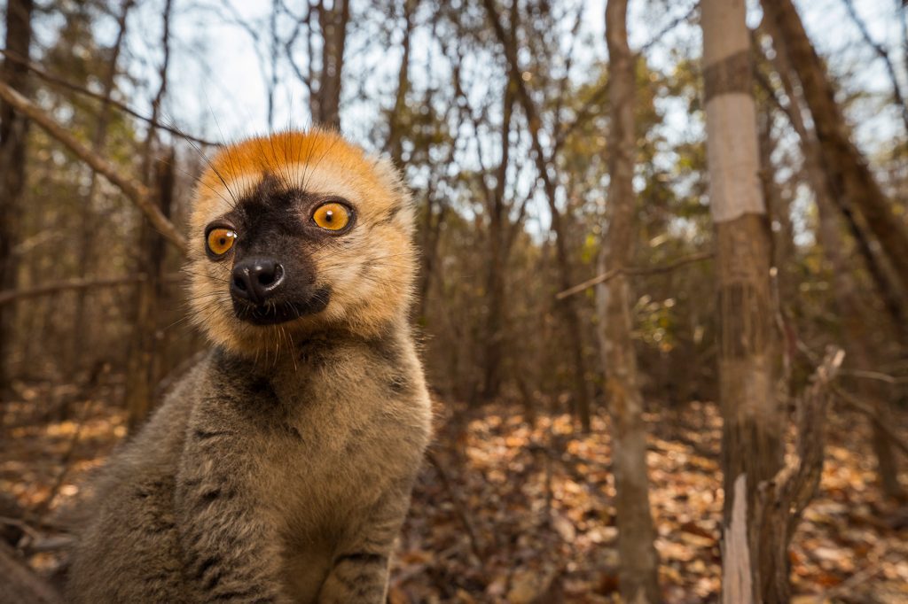
IUCN has launched a second call for proposals under its SOS Lemurs initiative to support targeted conservation action for Madagascar’s threatened lemurs. The call is open until Wednesday 9 July 2025 at 14:00 PM CEST.
Related content
Primary tools and resources
Indigenous Peoples and Local Community Conserved Areas (ICCAs)
ICCAs are territories and areas that are conserved by indigenous peoples and local communities. They have three main characteristics: (i) the community has a close connection with the territory or area; (ii) the community makes and enforces management rules; (iii) the management of the area results in positive conservation outcomes. The ICCA Registry is an online platform for territories and areas conserved by indigenous peoples and local communities (ICCAs), where communities themselves provide data, case studies, maps, photos and stories. There are currently over 1,500 protected areas and other effective area-based conservation measures (OECMs) reported to Protected Planet under the governance of indigenous peoples and local communities.
How to use
To access the ICCA Registry: https://doi.org/10.34892/an6v-a590
To explore sites, visit the WDPA OECM search page and filter by governance type: https://www.protectedplanet.net/en/thematic-areas/oecms?tab=OECMs
CITES Trade database
The CITES trade database currently holds 7 million records of trade in wildlife and 50,000 scientific names of taxa listed by CITES. It is managed by UNEP-WCMC on behalf of the CITES Secretariat. Trade data can be searched by year, taxon, purpose, or importing / exporting country. The complete database can be downloaded (version 2023.1).
The CITES Trade Database can be queried using the novice querying route (a step by step by wizard) or the expert query route (for those already familiar with CITES trade data).
A Guide to Interpreting Outputs from the UNEP-WCMC CITES Trade Database is available.
International policy framework for blue carbon ecosystems
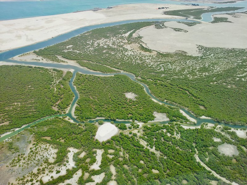
Coastal blue carbon ecosystems, including mangroves, seagrasses and tidal marshes, are some of the most carbon-rich ecosystems on Earth, and are vital to mitigating the impacts of climate change. They are also critical for coastal biodiversity, food security, livelihoods and human well-being, in addition to climate adaptation – protecting millions of people globally from the impacts of storms, coastal flooding and erosion. However, these ecosystems are threatened – half of global mangrove forests have already been lost – and once these ecosystems are degraded or destroyed, their carbon stores are released as carbon dioxide, contributing to climate change. This policy framework, developed by Conservation International and IUCN, provides an overview of the intersections and opportunities for blue carbon ecosystem conservation and restoration in the relevant international policy processes.
IUCN Global Ecosystem Typology 2.0
Ecosystems are critically important components of Earth’s biological diversity and as the natural capital that sustains human life and well-being. Yet all of the world’s ecosystems show hallmarks of human influence, and many are under acute risks of collapse, with consequences for habitats of species, genetic diversity, ecosystem services, sustainable development and human well-being. The IUCN Global Ecosystem Typology is a hierarchical classification system that, in its upper levels, defines ecosystems by their convergent ecological functions and, in its lower levels, distinguishes ecosystems with contrasting assemblages of species engaged in those functions. This report describes the three upper levels of the hierarchy, which provide a framework for understanding and comparing the key ecological traits of functionally different ecosystems and their drivers. An understanding of these traits and drivers is essential to support ecosystem management.
Guidelines for rewilding
These guidelines offer both a call for change and general guidance for users. The following five guidelines, adapted from the ten guiding principles for rewilding (Carver et al., 2021), provide a foundation for understanding and taking action to prevent further losses in nature, promote the recovery of biodiversity, and support the restoration of ecological integrity.
The Global Platform for Sustainable Cities
This World Bank initiative presents the scientific basis for why and how incorporating biodiversity and nature into urban design is crucial for achieving sustainability and resilience in cities and beyond. The report defines key terms and concepts, explores what urban leaders can do to promote them, and offers practical tools and approaches for incorporating urban nature and biodiversity into decision-making.
Guidance on other effective area-based conservation measures (OECMs)
The Kunming-Montreal Global Biodiversity Framework, adopted in 2022, provides a framework for the effective implementation of the Convention on Biological Diversity (CBD) through four goals and 23 targets. Target 3 (known as the ‘30×30 target’) calls on Parties to conserve at least 30% of terrestrial, inland waters, and coastal and marine areas by 2030. These guidelines are designed to promote good practices relating to identifying, reporting, monitoring and strengthening OECMs. They are intended for use by a wide range of rightsholders and stakeholders to promote understanding of whether a site meets the CBD criteria for identifying an OECM, how to report OECM data at the national and global levels, and how to monitor and strengthen OECMs.
IUCN Save Our Species
Through the hard work of our grantees, advice from IUCN’s many species experts and the support of our incredible donors and partners, we are able to deliver great impact for species threatened with extinction.
Why protect species
The alarm has been raised repeatedly about the decline in biodiversity across the planet. By allowing this decline to continue, we erode the very foundations of our existence.
Current initiatives
IUCN Save Our Species’ current portfolio is made up of almost 90 projects from all over the world. They are integrated into region-focused or species-focused initiatives.
The IUCN Urban Alliance
The Urban Alliance is a diverse global coalition of international partners committed to bringing cities into balance with nature. Several resources are available including an IUCN briefing paper, the Urban Nature Indexes: methodological framework and key indicators, and the IUCN Urban Toolbox. This is a catalogue of IUCN knowledge products on urban biodiversity that provides guidance to subnational governments, municipalities, and urban professionals on nature-positive development in urban environments. The tools featured support assessment, planning, design, implementation, and monitoring.
How to use
- Information on The Urban Alliance can be accessed at: https://iucnurbanalliance.org
- The Briefing paper on Cities and Nature can be downloaded at: https://www.iucn.org/resources/issues-brief/cities-and-nature
- The Urban Nature Indexes: methodological framework and key indicators can be downloaded at: https://portals.iucn.org/library/node/50782
- The IUCN Urban Toolbox is available in English, French and Spanish at: https://iucnurbanalliance.org/iucn-urban-toolbox-released-in-english-french-and-spanish/
AEWA International Single and Multi-Species Action Planning Format and Guidelines
These guidelines are produced by the Agreement on the Conservation of African-Eurasian Migratory Waterbirds. The revised version includes Multi-Species Action as well as making AEWA Plans more implementable, accessible, and practical for implementing agencies. The guidelines also recognise the need for activities to be more targeted and aligned with the set objectives and goals.
The IUCN Restoration Barometer
The IUCN Restoration Barometer is designed for use by countries that have committed to restore landscapes under international goals or agreements. It is used by governments to track the progress of restoration targets across all terrestrial ecosystems including coastal and inland waters. The Barometer allows governments to simplify and streamline reporting on their restoration commitments and it to track and record progress towards global goals, including The Bonn Challenge, the 30×30 target under the Post-2020 GBF, the Paris Agreement, and the Land Degradation Neutrality Target. Ecosystem restoration interventions are classified according to the IUCN Restoration Intervention Typology for Terrestrial Ecosystems (RITTE) and categorization of ecosystems by the UN Decade on Ecosystem Restoration. The Barometer has eight indicators and records the size of the area being brought under restoration as well as the corresponding climate, biodiversity, and socio-economic benefits. Currently, only government focal points can create accounts on the Barometer website. New users can request an account and after verification, restoration related data can be entered securely. A set of simple tutorials is provided to assist the process.
IUCN Green Status of Species
The decline of many species towards extinction has largely focused conservation efforts on ensuring that species remain extant. However, conservationists have long recognised the need to complement this by aiming to recover depleted populations throughout a species’ range and to restore species to ecosystems from which they have been extirpated. The main objectives of the IUCN Green Status of Species are: to provide a standardised framework for measuring species recovery; to recognise conservation achievements; to highlight species whose current conservation status is dependent on continued conservation actions; to forecast the expected conservation impact of planned conservation action; and to elevate levels of ambition for long-term species recovery. These objectives together encourage conservation towards species recovery, throughout a species’ range.
The Mohamed bin Zayed Species Conservation Fund
The Mohamed bin Zayed Species Conservation Fund The Fund was established in 2008 with an initial endowment of €25,000,000 to: Provide targeted grants to individual species conservation initiatives; Recognize leaders in the field of species conservation; and Elevate the importance of species in the broader conservation debate. The Fund provides small grants to boots-on-the-ground, in-the-field species conservation projects for the world’s most threatened species.
The Fund is open to applications for funding support from all parts of the world for direct conservation projects focused on threatened plant, animal, and fungus species. Grants are awarded according to criteria set by the Species Fund, and are for a maximum of $25,000.
IUCN WCPA Diagnostic tool for transboundary conservation planners
This tool (i) supports the decision-making process when establishing and implementing transboundary conservation initiatives; (ii) minimizes the risks of the process; (iii) enables planners to assess the feasibility of design and implementation of transboundary conservation measures. Version 2.0 was released by IUCN’s World Commission on Protected Areas (WCPA) Transboundary Conservation Specialist Group in June 2020.
How to use
For further details and to access the tool:
TRAFFIC Wildlife Trade Portal
The TRAFFIC Wildlife Trade Portal is an interactive tool that displays TRAFFIC’s wildlife seizure and incident database. The results are displayed as a list and as a dashboard, showing, for example, a summary in a chart or on a map. Clicking on individual records shows more in-depth information about a specific incident, such as the species, commodities and locations involved. The results can be exported to CSV format for further analysis. Relevant data or files can be uploaded and checked by TRAFFIC before their inclusion in the Portal.
CBD Guidance on enhancing positive and minimizing negative impacts on biodiversity of climate change adaptation activities
This document was produced by the CBD Subsidiary Body on Scientific, Technical and Technological Advice (SBSTTA) in 2016. It provides guidance on enhancing the positive and minimizing the negative impacts on biodiversity of climate change mitigation and adaptation activities, based on recent literature, case studies, and experience.
Section I presents the main principles of enhancing positive and reducing negative impacts of climate change adaptation activities on biodiversity. Section II provides guidance on enhancing positive and minimizing negative impacts of climate change adaptation activities, with specific examples from different sectors and ecosystems. Section III provides examples of tools to enhance the benefits and reduce the negative impacts of mitigation on biodiversity, with references to other reports where additional information can be found.
Responsible Business Alliance Practical Guide to Responsible Sourcing of Goods and Services
The Responsible Business Alliance (RBA) Practical Guide to Responsible Sourcing of Goods and Services outlines standard procurement steps to appropriate RBA tools and resources, to help give buyers confidence the products that they procure from RBA members are made in socially and environmentally responsible ways.
IUCN Red List of Threatened Species
The IUCN Red List of Threatened Species (the Red List) is the globally recognised standard on assessing extinction risk. Red List assessments are used by the Convention on Biological Diversity, CITES, other inter-governmental agreements, national governments, and conservation planners. The Red List assigns species into one of 8 categories based on 5 criteria, all with quantitative thresholds. The three highest categories of threat – Critically Endangered, Endangered, Vulnerable – are collectively considered ‘Threatened’. The Red List process has been formalized to support objectivity and scientific rigour. Red List assessments are carried out by SSC Red List Authorities, Red List Partners, IUCN staff, and regional and national agencies. In addition, Red List assessments provide a compendium of information on species, (taxonomy, geographic range, population, habitat and ecology, threats, conservation actions). The Red List operates at global, regional, and national levels. Guidelines for application at national or regional levels have been developed and the National Red List Working Group provides additional support.
Red List Authorities have been established for all major taxonomic groups included on the IUCN Red List. In most cases, the RLA is a sub-group within an IUCN SSC Specialist Group responsible for the species, groups of species or species within a specific geographic area. There are some exceptions; for example, BirdLife International is the designated RLA for all birds.
The process is guided by Rules of Procedure, supported by guidelines on application of the Red List Categories and Criteria, the Species Information Service (SIS) data entry and management system, and certification for assessors and RL trainers. All these materials can be downloaded, free, from the Red List website. A free, online training course for Red List assessors, is available.
Species can be assessed for the Red List at global, regional, and national levels. Guidelines for the Regional (and national) Application of the Categories and Criteria have been developed and support for development of national Red Lists is available from the National Red List Working Group.
How to use
- To check the global Red List status of a species and access the supporting information, visit the species assessment page on the Red List website
- To download the Red List Categories and Criteria, Guidelines, Rules of Procedure, and Guidelines for Application at Regional Level go the Red List resources
- To initiate or to contribute to a global assessment, contact the Chair of the relevant IUCN SSC Specialist Group or Red List Authority, for birds, see BirdLife International
- For taxonomic groups not listed, contact the relevant IUCN SSC Conservation Committee: Marine, Invertebrate, Plant, Fungi, Freshwater, Red List, Standards and Petitions.
- To develop a National Red List for a species or group of species visit the National Red List Working Group
- To obtain details or register for an online Red List training course: https://www.iucnredlist.org/resources/online
Global Biodiversity Information Facility
GBIF is an international network and data infrastructure funded by the world’s governments. It provides open access to data on all types of life on Earth. GBIF provides data-holding institutions around the world with common standards, best practices and open-source tools enabling them to share information on species. The data derive from many sources, from museum specimens collected in the 18th and 19th centuries to DNA barcodes and citizen science smartphone photos.
The network collates these diverse data sources through data standards, including Darwin Core, which forms the basis for most of GBIF’s index of hundreds of millions of species occurrence records. Publishers provide open access to their datasets using machine-readable Creative Commons licence designations, allowing scientists, researchers, and others to apply the data.
IUCN Save Our Species
Through the hard work of our grantees, advice from IUCN’s many species experts and the support of our incredible donors and partners, we are able to deliver great impact for species threatened with extinction.
Why protect species
The alarm has been raised repeatedly about the decline in biodiversity across the planet. By allowing this decline to continue, we erode the very foundations of our existence.
Current initiatives
IUCN Save Our Species’ current portfolio is made up of almost 90 projects from all over the world. They are integrated into region-focused or species-focused initiatives.
IUCN Guidelines for conserving connectivity through ecological networks and corridors
Connectivity conservation is essential for managing healthy ecosystems, conserving biodiversity and adapting to climate change across all biomes and spatial scales. Well-connected ecosystems support a diversity of ecological functions such as migration, hydrology, nutrient cycling, pollination, seed dispersal, food security, climate resilience and disease resistance. These Guidelines are based on the best available science and practice for maintaining, enhancing and restoring ecological connectivity among and between protected areas, other effective areas based conservation measures (OECMs) and other intact ecosystems. For the first time, this publication introduces a common definition and recommends formal recognition of ecological corridors to serve as critical building blocks of ecological networks in conjunction with protected areas and OECMs. Furthermore, these Guidelines also include 25 case studies that demonstrate current approaches to conserving ecological connectivity and ecological networks for different ecosystems and species, and at different spatial and temporal scales.
Global Taxonomy Initiative
The Global Taxonomy Initiative (GTI) was established by the CBD to address the lack of taxonomic information and expertise available in many parts of the world, and thereby to improve decision-making in conservation, sustainable use, and equitable sharing of the benefits derived from genetic resources. The GTI was developed by governments under the Convention on Biological Diversity and is implemented by governments, non-government and international organizations, taxonomists, and institutions.
The GTI is specifically intended to support implementation of the work programmes of the Convention on its thematic and cross-cutting issues. The Guide to the GTI includes an introduction, the programme of work, and links to further information. The European GTI Toolkit is a comprehensive tool that covers GTI topics in further detail.
African Wildlife Poisoning Database
The Vulture Specialist Group of the IUCN Species Survival Commission gathers and collates data on historical and current incidents of wildlife poisoning to assess the scope and impact of this threat to vultures and other scavenging birds and wildlife on the African continent. The Database is accompanied by a map of poisoning incidents in Africa. A webform and a data submission template have been designed to facilitate simple uploading of records of poisoning incidents.


