

Задача 12
Улучшение зеленых пространств и городского планирования для обеспечения благополучия человека и биоразнообразия
Существенное увеличение площади и качества зеленых и голубых пространств в городах и густонаселенных районах, повышение их связности и доступности, а также выгод от их использования на долгосрочной основе путем содействия сохранению и устойчивому использованию биоразнообразия и обеспечение городского планирования с учетом биоразнообразия при улучшении состояния естественного биоразнообразия, повышении экологической связности и целостности, укреплении здоровья и благополучия человека, а также его связи с природой, и содействии инклюзивной и устойчивой урбанизации и предоставлению экосистемных функций и услуг.

Существенное увеличение площади и качества зеленых и голубых пространств в городах и густонаселенных районах, повышение их связности и доступности, а также выгод от их использования на долгосрочной основе путем содействия сохранению и устойчивому использованию биоразнообразия и обеспечение городского планирования с учетом биоразнообразия при улучшении состояния естественного биоразнообразия, повышении экологической связности и целостности, укреплении здоровья и благополучия человека, а также его связи с природой, и содействии инклюзивной и устойчивой урбанизации и предоставлению экосистемных функций и услуг.
Обоснование
ГПДВ
Надлежащее размещение, проектирование и управление зелеными и голубыми пространствами может обеспечить дополнительные места обитания для диких видов и улучшить их связность, наряду с обеспечением выгод для здоровья и благополучия человека.
Primary tools and resources
The Global Platform for Sustainable Cities
This World Bank initiative presents the scientific basis for why and how incorporating biodiversity and nature into urban design is crucial for achieving sustainability and resilience in cities and beyond. The report defines key terms and concepts, explores what urban leaders can do to promote them, and offers practical tools and approaches for incorporating urban nature and biodiversity into decision-making.
The IUCN Urban Alliance
The Urban Alliance is a diverse global coalition of international partners committed to bringing cities into balance with nature. Several resources are available including an IUCN briefing paper, the Urban Nature Indexes: methodological framework and key indicators, and the IUCN Urban Toolbox. This is a catalogue of IUCN knowledge products on urban biodiversity that provides guidance to subnational governments, municipalities, and urban professionals on nature-positive development in urban environments. The tools featured support assessment, planning, design, implementation, and monitoring.
How to use
- Information on The Urban Alliance can be accessed at: https://iucnurbanalliance.org
- The Briefing paper on Cities and Nature can be downloaded at: https://www.iucn.org/resources/issues-brief/cities-and-nature
- The Urban Nature Indexes: methodological framework and key indicators can be downloaded at: https://portals.iucn.org/library/node/50782
- The IUCN Urban Toolbox is available in English, French and Spanish at: https://iucnurbanalliance.org/iucn-urban-toolbox-released-in-english-french-and-spanish/
Guidelines for wildlife disease risk analysis
This IUCN-OIE publication provides an overview of the science-based processes and tools available for wildlife disease risk analysis and their application to a broad range of contemporary issues, including human-wildlife interactions, domestic animal-wildlife interactions and the impacts of massive ecological change on biodiversity conservation. The guidelines will be of value to those policy makers and decision makers faced with the social, political and technical complexities involved in wildlife-disease-associated scenarios.This is a companion volume to the Manual of Procedures for Wildlife Disease Risk Analysis.
Other tools and resources
Kelp Blue
Kelp Blue is a commecial entitiy founded by Daniel Hooft in February 2020. Its business headquarters are in Zeist, The Netherlands. It has a subsidiary in Namibia with operational headquarters in Luderitz, Nambibia. At the moment it employs 12 full time employees, 5 part-time employees and 4 interns. The gender balance is 50% female, 50% male. Its mission is “to rewild the oceans by cultivating giant kelp forests”
Kelp Blue focused first on its MISSION. Next we needed to find FUNDING. We obtained in-pinciple funding from Climate Investor Two and Eos Capital for USD $60million.
At the same time we have built a strong competent multi-disciplinary TEAM with deep experience in multiple industries. Each of us brings our own learnings and unique skills to the table; this means we can take advantage of different perspectives and best practices as we look to grow Kelp Blue.
Always focus on your mission – it will dictate all of the decisions you from whom you employ, the selection of suppliers and even your processing techniques.
Having stong funding partners with the same vision is key.
Don’t underestimate the time and energy fundraising takes, start at least 6 months before you really need the funds.
Réhabilitation des terres par le reboisement – le pouvoir des droits de propriété dans la chaîne de valeur du bois-énergie vert
Répondre à la demande croissante en bois-énergie est un défi et un facteur de déforestation et de dégradation des forêts. La Restauration des Paysages Forestiers (RPF) et les engagements des pays envers l’AFR100 s’adressent ainsi à la production durable de bois-énergie afin de répondre aux réalités sociales et économiques.
La chaîne de valeur bois-énergie, en s’adressant à toutes les parties prenantes, encourage les petits entrepreneurs. L’approche combine des éléments juridiques, de gouvernance, économiques et techniques depuis les transferts des titres fonciers et des plans de reforestation individuels sur des terres dégradées au niveau villageois jusqu’à la récolte, traitement, transformation, distribution et commercialisation par les consommateurs finaux de bois-énergie ainsi que les technologies de combustion associées (foyers améliorés).
Elle modernise la chaîne de valeur du bois-énergie et génère des bénéfices pour les intervenants. Leurs revenus annuels ont doublé en moyenne.
Gestion artificielle d’espèces végétales pionnières en contexte forestier : aux antipodes de la dynamique naturelle.
La réserve biologique dirigée (RBD) du Hochfeld a pour enjeu principal la conservation d’une exceptionnelle population de lycopodes (6 taxons). Au sein d’une forêt dense de hêtre, un aménagement réalisé dans les années 1960 a occasionné un déboisement et même un décapage du sol. Cette atteinte à la forêt a été suivie de la reconstitution spontanée d’une lande pionnière à éricacées très rase, qui a permis l’apparition des lycopodes. Les conditions n’auraient pas pu être aussi favorables dans le cas d’une coupe forestière, moins traumatisante pour le milieu et qui aurait été suivie d’une reconstitution rapide du peuplement, sans véritable interruption de la végétation forestière.
Il n’y a pas d’historique pastoral dans la RBD du Hochfeld, et le bétail risquerait de toute façon d’occasionner trop de dégâts aux lycopodes. On se trouve dans une situation où l’entretien de la lande se fait donc nécessairement par la combinaison de la mécanisation et d’interventions manuelles.
Des engagements internationaux à la mise en œuvre locale – la restauration des paysages forestiers à Madagascar
Le bien-être des habitants de Madagascar dépend de ses ressources naturelles et de ses services, tels que le bois de feu, la nourriture et l’eau. De nombreuses zones sont dégradées dues à l’utilisation non durable des terres. Les aléas climatiques ajoutent plus de risques pour les personnes, la nature et l’économie. La restauration des paysages forestiers (RPF) est une priorité clé de l’AFR100 pour assurer un développement durable. Les écosystèmes résilients améliorant l’économie, la sécurité alimentaire et l’approvisionnement en eau, la conservation et la séquestration du carbone en sont les piliers. Cette solution couvre la mise en place de plateformes multiséctorielles , les mesures de renforcement des capacités des acteurs, le développement d’une stratégie nationale RPF et la priorisation des payasages à restaurer basées sur une évaluation multicritère. Les prochaines étapes consisteront à identifier des sites pour piloter des activités de restauration dans la région Boeny.
Restauration des Paysages Forestiers et mise en valeur du terroir villageois de Mogazang au Cameroun
La désertification et ses conséquences menacent le bien-être de la population du nord du Cameroun, en particulier des ménages ruraux. Le manque de feu de bois et bois de construction, et l’extrême pauvreté sont des défis majeurs pour la population de Mogazang. Les aléas climatiques comme la modification des régimes de précipitations exacerbent aussi risques pour la population. L’élaboration d’une carte par les membres de la communauté a permis la démarcation d’un terrain dégradé (10,74 ha) à restaurer. En adoptant une approche «d’apprentissage par la pratique», différentes techniques de restauration de la fertilité des sols ont été testées. En attendant que la parcelle soit productive, les femmes ont été formées à des activités alternatives génératrices de revenus et à la construction de foyers améliorés. L’initiative contribue ainsi aux objectifs de l’AFR100 par la restauration des terres dégradées, la réduction de la pression sur les ressources naturelles et la génération de revenus.
Revolución de los Baldes: Compostaje Comunitario de Residuos Orgánicos Domésticos
Desde 2008, el proyecto Revolución de los Baldes impacta en la comunidad necesitada de Chico Mendes, ubicada en el barrio Monte Cristo, en Florianópolis-SC. El objetivo de este proyecto es fomentar la gestión comunitaria de residuos orgánicos, promover la agricultura urbana y la inclusión socioeconómica de los participantes en la iniciativa. En esta práctica, se aplica el método de compostaje termofílico en las esterillas estáticas con ventilación pasiva con el fin de reciclar los residuos orgánicos transformándolos en abonos orgánicos. La logística del proyecto se basa en la distribución de baldes a las familias interesadas en la segregación de los orgánicos en sus hogares y el posterior descarte en bombonas situadas en puntos de entrega voluntaria estratégicamente distribuidos en las calles. Los jóvenes que participan en la iniciativa son responsables de la concienciación de la comunidad sobre la adecuada separación de los residuos orgánicos en origen.
Siembra y cosecha de agua de lluvia frente a la sequía en cabecera de cuencas Cachi-Mantaro y Pampas
Siembra y cosecha de agua de lluvia (SCALL), es un modelo hidrológico campesino cuyo enfoque es la crianza del agua de lluvia en el marco de la cosmovisión local. Es una práctica colectiva como respuesta a la creciente escasez de agua. La experiencia combina la infraestructura verde con prácticas culturales, sociales y ambientales. Los beneficios: formación de humedales, recarga de manantiales, fortalecimiento de la relación con la naturaleza, valoración cultural y una perspectiva de servicio ecosistémico a la ciudad de Huamanga.
Carne del Monte fomenta la ganadería sustentable en México
Neek ’Capital es un company builder que nació en el 2017 con la misión de crear compañías mexicanas nuevas con potencial de crecimiento, dedicadas a la implementación del uso sustentable de la energía, el agua, los sistemas alimenticios y la biodiversidad a grande escala. El objetivo era crear empresas destinadas a resolver los desafíos planteados por el uso sustentable de los recursos naturales en un mundo con restricciones climáticas.
A través de nuestras operaciones de producción, procesamiento y comercialización, buscamos la regeneración del campo como fuente sustentable de proteína animal de alta calidad e invertir directamente en la restauración de la selva Yucateca.
Buscamos ser un ejemplo de sustentabilidad mediante el uso de sistemas productivos regenerativos que se mantengan en el largo plazo, mejorando así los ingresos de los productores y la calidad agroecológica de sus ranchos ganaderos.
Restauración ecológica en la Zona de Amortiguamiento del Parque Nacional Cordillera Azul
El proyecto Restauración Cordillera Azul viene impulsando procesos de restauración ecológica en los poblados de San Juan y Lejía en la región San Martín desde el 2018, en 50 hectáreas que conectan con un paisaje de 500 ha, en la Zona de Amortiguamiento del Parque Nacional Cordillera Azul (PNCAZ). Para ello CIMA (organización que ejecuta el contrato de administración del PNCAZ) ha suscrito un convenio de cooperación entre la Universidad Nacional Agraria de la Selva, el caserío de San Juan y el centro poblado de Lejía. Las comunidades tienen Acuerdos Azules de colaboración, como estrategia participativa de planificación territorial y de los Planes de Calidad de Vida.
Ciudades Resilientes: Área Protegida Urbana de la Universidad de Buenos Aires
Durante los años 60 se desarrollaron muchos vertederos en el Río de la Plata, Argentina. Estas acciones crearon un nuevo ecosistema de origen antropogénico.
En 1985, un movimiento estudiantil comenzó a trabajar para proteger este sitio que se conocía como La Reserva Biológica y Parque para la Difusión de la Ciencia.
La reserva fue el primer área urbana de Buenos Aires. Con el apoyo de las autoridades, comenzó un trabajo de tres décadas, y en 2011 el lugar fue designado por ley como un área urbana protegida llamada Ciudad Universitaria, Reserva Ecológica.
Este sitio juega un papel esencial en la universidad y la ciudad de Buenos Aires, brindando servicios ambientales estratégicos para la salud humana. Es un excelente ejemplo de cómo los parques urbanos son esenciales para el bienestar de las personas que viven en las ciudades.
Proceso de integración de las áreas protegidas al ordenamiento territorial colombiano
Han incrementado las presiones sobre áreas protegidas (AP) poniendo en riesgo la conservación de biodiversidad y la provisión de servicios ecosistemicos. En la planificación de los modelos de ocupación del territorio, usos del suelo y desarrollo promovidos por municipios, departamentos, la nación y sectores productivos las AP estan ausentes o son percibidas como limitantes del progreso A su vez las AP siguen planificandose de limites hacia dentro aisladas de los territorios de los cuales hacen parte. Es imprescindible e inaplazable que las AP se integren en los planes de ordenamiento territorial. Nuestro proceso ha combinado acciones de tipo político, técnico y operativo. Hoy Parques Nacionales hace parte del Comté Especial Interinstucional de la Comisión de Ordenamiento Territorial de Colombia, ha logrado las AP hayan sido incluida instrumentos ordenamiento territorial municipal, departamental y nacional, desarrolla casos piloto diferentes sitios del pais y capacita diferentes actores
The Ultimate Guide to Eco-Friendly Gardening
Ecologically friendly gardening practices, or ‘eco-friendly gardening’ as they are affectionately known, are forward thinking methods of gardening that are responsive to the global threats of climate change. These innovative outdoor endeavours focus upon reducing the emissions of greenhouse gases that occur as a direct result of modern day gardening practices. Eco-friendly gardening also encourages the absorption of carbon dioxide by soils and plants in order to lessen the effects of global warming.
Solutions and case studies
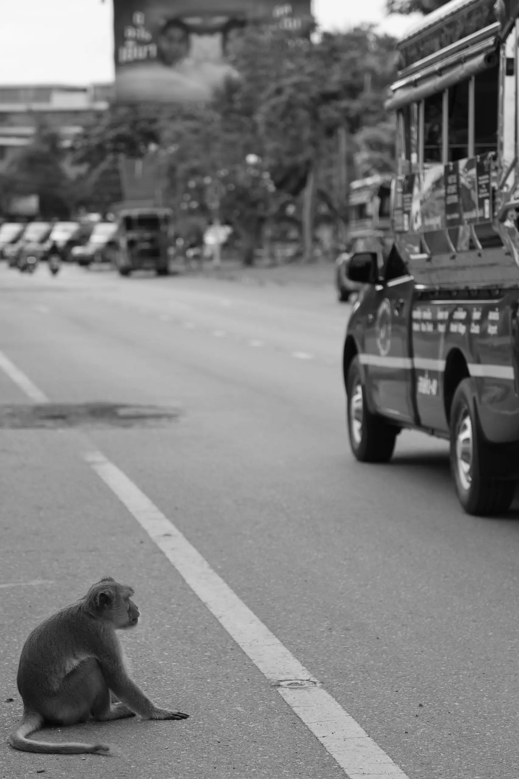
Results-based budgeting in the Pak Kret City Municipality, Thailand: Integrating biodiversity targets into local government budgets
Pak Kret City Municipality is located on the Chao Phraya River plain in Thailand, an area with fertile soil for agriculture. The subdistrict is home to 63 native durian varieties, a flavorful tropical fruit. However, unplanned urban expansion, pollution, and climate change have threatened urban biodiversity and agricultural activities in Pak Kret. Its proximity to Bangkok, only 20 kilometers away, intensifies these pressures.
Amid this situation, Pak Kret City Municipality, with support from the Biodiversity Finance Initiative (BIOFIN) of the United Nations Development Programme (UNDP), adopted results-based budgeting: an approach that integrates biodiversity targets into government budgets, thereby increasing nature-positive investments.
As a result, Pak Kret invested USD 11 million (THB 372 million) — 17% of its total budget — in biodiversity in 2025, reflecting priority concerns to protect its distinctive durian variety, expand green spaces, and enhance air quality, water, and waste management systems.
Smart DESERT project: Sustainable Agriculture for Resilient Livelihoods and Economic Empowerment
The Smart DESERT project was funded by the French Development Agency (AFD) with a total budget of EUR 10 million and implemented by a consortium of organisations led by IUCN ROWA, targeting the area of the North-East Badia highlands in Jordan. The project was designed to achieve two key objectives: (1) increased year-round income and (2) improved work conditions, with an overarching goal of economic empowerment of Syrian refugees and vulnerable Jordanians in the agricultural sector.
The project addresses key challenges such as water scarcity, land degradation, rural unemployment, and limited market access. By introducing water harvesting systems, regenerative agriculture practices, and digital tools, Smart DESERT helps farmers improve productivity, conserve natural resources, and build climate resilience. It also supports the creation of home-based agribusinesses and facilitates connections to markets and finance.
La participación comunitaria y corresponsable para la creación y manejo del "Sendero Lineal Cinturón Verde"
Proyecto dirigido a fomentar la corresponsabilidad de los ciudadanos de Hermosillo, Sonora para la construcción del Sendero Lineal “Cinturón Verde, el cual delimita la zona de amortiguamiento entre el Desarrollo Urbano y un área de conservación ecológica en zona peri urbana árida.
Se implementó una campaña de comunicación y de educación ambiental para dar a conocer el proyecto y fomentar la participación social así como la creación de comités de vecinos para el co-manejo del sendero.
Adicionalmente con este proyecto se busca incrementar el bienestar a través del contacto con la naturaleza y propiciar un entorno más seguro, conservando lo natural y de fácil acceso para las familias.
El té que renace al Bosque Atlántico: Yerba mate, cultura y biodiversidad.
El Bosque Atlántico es considerado uno de los bosques tropicales más biodiversos del planeta (Hotspot de biodiversidad), el segundo más grande toda Sudamérica y la primera Área Importante para las Aves (IBA) del Paraguay con alto endemismo de aves y especies amenazadas. Actualmente el desarrollo de agricultura extensiva y urbanización redujo su cobertura original a menos del 7% de superficie en Paraguay. San Rafael ha sido ampliamente reconocido como la principal prioridad de conservación del Bosque Atlántico en Paraguay. La solución para su conservación a largo plazo y evitar la pérdida de conectividad con otras áreas importantes del Bosque Atlántico, consiste en un modelo de producción innovador basado en la recuperación de áreas degradadas del Bosque Atlántico en el área de influencia de San Rafael con Ilex paraguariensis – yerba mate con otras especies nativas, fomentando su conservación tanto natural como cultural, así como su viabilidad económica de comunidades rurales e indígenas.
Impulsando la cadena de valor del café en pequeños productores a través de la agroecología y su diversificación
El café con sombra representa más del 66% de la Reserva de Biosfera Apaneca-Ilamatepec en El Salvador, que interconecta y posibilita el flujo de especies de flora y fauna. Sin embargo, este cultivo tiene dos grandes amenazas: la primera, es la eliminación del cafetal debido al cambio de uso de suelo para urbanización, y la segunda, el reemplazo de los cafetales para cultivos de granos básicos y hortalizas.
En ese sentido, el proyecto del Fondo de Desarrollo Verde en la región SICA en El Salvador denominado “Apalancamiento de fincas con manejo agroecológico del agrosistema de café en la Reserva de Biosfera Apaneca-Ilamatepec” trabajó con 50 productores y productoras para la restauración de ecosistemas y paisajes a través de la producción agroecológica y diversificada en el cultivo de café. Esto permitió que los ingresos mejorarán gracias a nuevos productos y al valor agregado que aporta el manejo agroecológico en el café, fortaleciendo la cadena de comercialización de los productos asociados al cultivo.
Áreas protegidas urbanas del Valle de Aburrá, un camino promisorio de gestión para la apropiación social de la biodiversidad y sus servicios ecosistémicos
El Valle de Aburrá es un paisaje interandino en el que se emplaza una ciudad de 3,6 mill. de habitantes. Gracias a notables procesos de participación ciudadana, valiosos esfuerzos técnicos y una voluntad política estable, la autoridad ambiental urbana ha declarado 6 áreas protegidas: Parque Natural Regional (Cerro El Volador) y Áreas de Recreación (Nutibara, La Asomadera, Piamonte, El Trianón-La Heliodora, y Ditaires). El Área Metropolitana del Valle de Aburrá ya cosecha los frutos del esfuerzo de conservación de la biodiversidad y los servicios ecosistémicos, la adaptación climática, y la calidad de vida en un contexto con grandes retos de contaminación del aire, déficit de espacio público, y salud pública. La acción estatal, la apropiación ciudadana/empresarial, y la gestión del conocimiento demuestran que estas áreas son laboratorio promisorio de transformación cultural y resiliencia urbana ante el cambio climático
Restauración Ecologica de Manglar en el Área de Conservación El Imposible -Barra de Santiago
El Área de Conservación El Imposible – Barra de Santiago tiene una extensión de 90,467 ha, con una elevación de 0 a 1400 msnm; posee diferentes tipos de ecosistemas que van desde costero-marinos, manglares, hasta cafetales y ecosistemas agropecuarios. La degradación en la zona es ocasionada por una alta presión de actividades agropecuarias, malas prácticas agrícolas que producen mayor erosión, pérdida de la productividad y aumento de los sedimentos en los cauces de los ríos. Se propone una solución integral para aumentar los servicios ecosistemicos que brindan los manglares, a traves de combinar el diálogo interinstitucional, las capacidades locales y acciones en campo para fomentar la reforestación y la regeneración natural del ecosistema degradado. Con organizaciones locales se implementan acciones de Restauración Ecologica de Manglar -REM-, que consiste en recuperación hidrodinamica del sitio, extracción de sedimentos, monitoreo de la biodiversidad y generación de empleo temporal.
Inversión Sostenible a Nivel de Paisaje
En el año 2012, se actualiza la Política Nacional de Ambiente en El Salvador y se crea el Programa de Restauración de Ecosistemas y Paisajes -PREP-, el cual tiene como objetivo promover y facilitar la restauración de ecosistemas y paisajes rurales para asegurar la provisión de servicios ecosistémicos claves, así como, la conservación de la biodiversidad para reducir el riesgo y adaptarse a los impactos del cambio climático en 5 paisajes priorizados.
Para el año 2014, las inversiones en restauración de ecosistemas y paisajes eran escasas, por lo que el Ministerio de Ambiente y Recursos Naturales de El Salvador -MARN- , a través del Acuerdo Ministerial No.31 definió la suscripción de convenios de cooperación con fondos ambientales, con el objeto de establecer mecanismos para darle cumplimiento a las medidas de compensación ambiental; y que los recursos identificados fueran invertidos en la restauración de ecosistemas y paisajes.
Silvocafé – Incorporando el manejo forestal en fincas de café como estrategia de restauración
En Centroamérica, la producción cafetalera ha sido negativamente impactada por la inestabilidad en los precios, impactando a los pequeños caficultores y sobre todo a los que tienen cafetales en zonas medias y bajas con calidad estándar.
El Silvocafé es un modelo de negocio agroforestal para cafetales bajo sombra que agrega el manejo y aprovechamiento silvicultural con árboles de perferencia nativos y de alto valor comercial (AVC). La solución esta basada en las experiencias implementadas en Guatemala y Costa Rica.
El modelo Silvocafé al implementarlo, le permite al caficultor restaurar el ecositema mejorando los servicios ecosistemicos (prevención de la erosión, captación de agua, reducción de la frangmentación del paisaje, aumento en la captación de carbono y conservación de la biodiversidad) en su terreno; al mismo tiempo, que produce subproductos de madera con arboles de AVC, con retornos a corto, mediano y largo plazo, según su planificación.
Incentivos Forestales con Enfoque Ecosistemico
Guatemala se comprometio a restaurar 1.2 Millones de hectareas en el Bonn Challenge. Para lograr su compromiso elaboró una estrategia nacional de restauración de paisajes y identifico al programa de incentivos forestales como el principal instrumento de politica publica. En el año 2015 con la publicación de la Ley PROBOSQUE, incorporó la modalidad de restauración y recuperación de tierras degradas.
Con esta solución se propuso un esquema para aumentar la oferta de bienes y servicios ambientales en ecosistemas estrategicos, empleando tecnicas y especies que brinden la mejor estructura ecologica del sitio a restaurar y ademas, aumenten la inversión publica en temas de restauración de paisajes.
La solución propone el siguiente metodo para incorporar el enfoque ecosistemico en los incentivos forestales: 1) Caracterización del ecosistema de referencia , 2) Definición de niveles de degradación, y 3) Propuestas de especies priorizadas para la restauración.
Integración del Enfoque de Restauración de Paisajes en la Cadenas de Valor Lactea
Los cantones de Puriscal y Turrubares son paisajes degradados por el avance de la frontera agrícola. El cultivo de tabaco y la ganadería extensiva causaron la pérdida del 60% de la cobertura forestal en el área entre las décadas de 1,950 a 1,980; actualmente, la ganadería doble propósito (carne y leche); y la agricultura (cultivos del café, hortalizas, caña de azúcar y plantas ornamentales) son los ejes principales de la economía de la zona.
Con esta solución se propuso un esquema para aumentar la oferta de bienes y servicios ambientales en sistemas silvopastoriles, incorporando: a) practicas sostenibles (introducción de pasto mejorado, inocuidad y ordeño limpio, sistemas de riego e incorporación del componente arboreo en las unidades productivas), y b) la combinación de financiamiento publico (PSA) y privado (Creditos).
Compensation sur les mises en défens pour la régénération du Cèdre de l'Atlas
The regeneration of Atlas cedar is very sensitive to grazing due to extensive stockbreeding, if not impossible. Regeneration has to be protected and farmers organized into associations have to be compensated for areas that are off-limits to grazing. A legislative text on the subject was therefore drafted. Compensation is provided with 250MAD/ha/year (soon 1000MAD), to be financed by the association in the form of development actions on its Pastoral Park in consultation with the water and forestry department.
Thanks to the Ifrane National Park, stockbreeders are currently organized into ten associations comprising 1,127 stockbreeders who receive a total of 205,3750MAD. The regeneration of the cedar is evolving more and more. They are working together on income-generating projects involving ecotourism, rangeland management, agro-ecology, water, etc., with the involvement of young people and women, bearing in mind that the ultimate goal is the regeneration of the cedar and the conservation of its ecosystem.
