

هدف 21
ضمان أن المعرفة متاحة ويمكن الوصول إليها لتوجيه العمل المتعلق بالتنوع البيولوجي
ضمان أن تكون أفضل البيانات والمعلومات والمعرفة المتاحة متوفرة لصناع القرار والممارسين والجمهور لتوجيه الحوكمة الفعالة والمنصفة والإدارة المتكاملة والتشاركية للتنوع البيولوجي، ولتعزيز الاتصال والتوعية والتعليم والرصد والبحث وإدارة المعرفة، وفي هذا السياق أيضًا، لا ينبغي الوصول إلى المعرفة التقليدية والابتكارات والممارسات والتقنيات للشعوب الأصلية والمجتمعات المحلية إلا بموافقتهم الحرة والمسبقة والمستنيرة، وفقًا للتشريعات الوطنية.

ضمان أن تكون أفضل البيانات والمعلومات والمعرفة المتاحة متوفرة لصناع القرار والممارسين والجمهور لتوجيه الحوكمة الفعالة والمنصفة والإدارة المتكاملة والتشاركية للتنوع البيولوجي، ولتعزيز الاتصال والتوعية والتعليم والرصد والبحث وإدارة المعرفة، وفي هذا السياق أيضًا، لا ينبغي الوصول إلى المعرفة التقليدية والابتكارات والممارسات والتقنيات للشعوب الأصلية والمجتمعات المحلية إلا بموافقتهم الحرة والمسبقة والمستنيرة، وفقًا للتشريعات الوطنية.
Rationale
GSAP
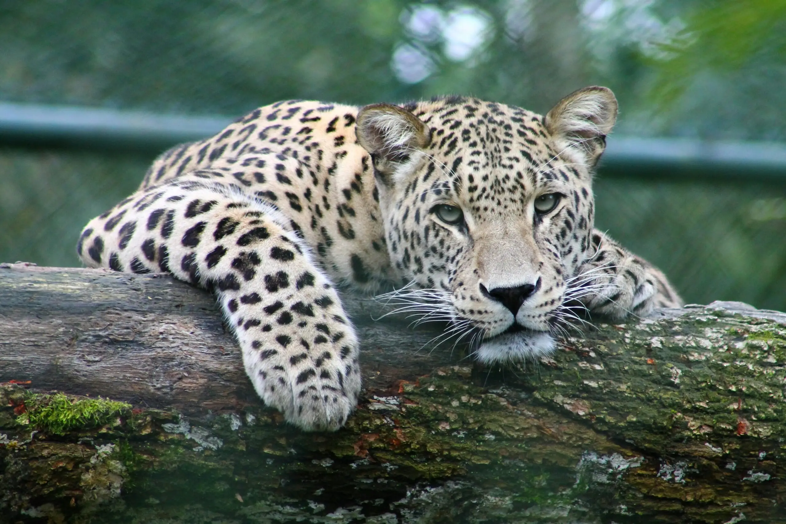
Knowledge of the status, distribution, population trend, ecology, and threats to species is essential to set priorities, inform planning, determine levels of sustainable use, and implement action effectively. IPLCs have much of this knowledge embedded in their practices and use of their lands and resources, especially those upon which their livelihoods depend. Systematic monitoring of species and the condition of their habitats is needed to track trends and measure effectiveness of conservation action.
Actions
Primary tools and resources
Encyclopedia of Life
The Encyclopedia of Life (EoL) aims to provide global access to knowledge about life on Earth by collecting and sharing knowledge in an open, freely accessible digital resource. EoL identifies sources of biodiversity knowledge that are legally and practically shareable and enriches their structure with modern data tools to integrate them with other data.
EoL works with open access biodiversity knowledge providers around the world, including museums and libraries, universities and research centers, individual scientists, graduate students and citizen science communities, and a suite of international open data hubs. EOL receive information from many sources, and format and annotate it so that search tools can find similar content from different sources.
Global Taxonomy Initiative
The Global Taxonomy Initiative (GTI) was established by the CBD to address the lack of taxonomic information and expertise available in many parts of the world, and thereby to improve decision-making in conservation, sustainable use, and equitable sharing of the benefits derived from genetic resources. The GTI was developed by governments under the Convention on Biological Diversity and is implemented by governments, non-government and international organizations, taxonomists, and institutions.
The GTI is specifically intended to support implementation of the work programmes of the Convention on its thematic and cross-cutting issues. The Guide to the GTI includes an introduction, the programme of work, and links to further information. The European GTI Toolkit is a comprehensive tool that covers GTI topics in further detail.
Global Biodiversity Information Facility
GBIF is an international network and data infrastructure funded by the world’s governments. It provides open access to data on all types of life on Earth. GBIF provides data-holding institutions around the world with common standards, best practices and open-source tools enabling them to share information on species. The data derive from many sources, from museum specimens collected in the 18th and 19th centuries to DNA barcodes and citizen science smartphone photos.
The network collates these diverse data sources through data standards, including Darwin Core, which forms the basis for most of GBIF’s index of hundreds of millions of species occurrence records. Publishers provide open access to their datasets using machine-readable Creative Commons licence designations, allowing scientists, researchers, and others to apply the data.
Database of Global Data Sources for Biodiversity Conservation Monitoring
The database has been developed by the IUCN SSC Species Monitoring Specialist Group with support from Re:wild. It includes 178 global data sources on: monitoring biodiversity state, pressures and threats; monitoring conservation responses to biodiversity loss, and those with multiple uses for biodiversity monitoring. A fact sheet answering frequently asked questions about the database is also available. The Species Monitoring Specialist Group is a voluntary network of experts from around the world and includes specialists on different species and taxa, on different monitoring techniques and issues, and on different types of data use. The group aims to enhance conservation by improving the flow of species data from collection point to decision-maker.
How to use
Version 3.0 of the database and the fact sheet can be downloaded at: https://www.speciesmonitoring.org/data-sources.html
A selection of Manuals, Guidelines and Methods Reviews is available at:
https://www.speciesmonitoring.org/guidelines-and-tools.html
To contact the Species monitoring Specialist Group: SpeciesMonitoring@gmail.com
Living Planet Index (LPI)
The Living Planet Index measures the state of the world’s biodiversity based on population trends of vertebrate species from terrestrial, freshwater, and marine habitats. The LPI has been adopted by the Convention of Biological Diversity (CBD) as an indicator of progress towards its targets. The LPI is compiled by WWF and ZSL based on trends in thousands of population time-series data collected from monitored sites around the world. The Living Planet Database contains population time-series data on the abundance of tens of thousands of vertebrate species between 1970 and 2021. It is publicly available, except for some confidential records that cannot be shared.
How to use
- The annual Living Planet Report can be downloaded at: https://www.wwf.org.uk/our-reports/living-planet-report
- The latest results and the technical supplement are available at: https://www.livingplanetindex.org/
- Data in the Living Planet Database can be searched or downloaded at:
IUCN Green List of Protected and Conserved Areas Standard
A protected or conserved area that reaches the IUCN Green List Standard is certified and recognised as achieving ongoing results for people and nature in a fair and effective way. A site that gains ‘Green List’ status demonstrates: Respect: for the local community through fair and meaningful engagement of rights-holders and stakeholders; Design: planning that identifies the needs to secure the important values of the area; Effective management: monitoring of the status of these important values; Successful conservation results: for nature and for people; Clear contribution: to climate change responses, health and well-being and other challenges. The seventeen criteria collectively describe the efforts needed to fully achieve the global Sustainability Standard and all must be achieved for a site to be green-listed. The indicators can be adapted to suit the local context. Any site can join, and work towards achieving verified success, and then attain the Standard or further improve.
The IUCN Restoration Barometer
The IUCN Restoration Barometer is designed for use by countries that have committed to restore landscapes under international goals or agreements. It is used by governments to track the progress of restoration targets across all terrestrial ecosystems including coastal and inland waters. The Barometer allows governments to simplify and streamline reporting on their restoration commitments and it to track and record progress towards global goals, including The Bonn Challenge, the 30×30 target under the Post-2020 GBF, the Paris Agreement, and the Land Degradation Neutrality Target. Ecosystem restoration interventions are classified according to the IUCN Restoration Intervention Typology for Terrestrial Ecosystems (RITTE) and categorization of ecosystems by the UN Decade on Ecosystem Restoration. The Barometer has eight indicators and records the size of the area being brought under restoration as well as the corresponding climate, biodiversity, and socio-economic benefits. Currently, only government focal points can create accounts on the Barometer website. New users can request an account and after verification, restoration related data can be entered securely. A set of simple tutorials is provided to assist the process.
The World Database on Protected Areas (WDPA)
The WDPA is a comprehensive global database on terrestrial and marine protected areas and Other Effective Area-based Conservation Measures (OECMs). It is a joint project between the UN Environment Programme and IUCN, and is managed by the World Conservation Monitoring Centre (UNEP-WCMC). The WDPA is updated on a monthly basis and site data and maps are available through the Protected Planet platform. About 261,766 officially recognised protected areas are listed, covering over 15% of the of the earth’s land surface and 7.4% of the world’s oceans. Protected Planet contains interactive maps and has eight thematic areas. Every two years, UNEP-WCMC releases the Protected Planet Report on the status of the world’s protected areas and makes recommendations on how to meet international goals and targets.
How to use
- To access the Protected Planet website and explore the World Database on Protected Areas (WDPA), World Database on OECMs, Global Database on Protected Area Management Effectiveness (GD-PAME), and associated information: https://www.protectedplanet.net
- To contribute information on a site to the WDPA: https://www.protectedplanet.net/en/thematic-areas/wdpa?tab=WDPA
IUCN Red List of Threatened Species
The IUCN Red List of Threatened Species (the Red List) is the globally recognised standard on assessing extinction risk. Red List assessments are used by the Convention on Biological Diversity, CITES, other inter-governmental agreements, national governments, and conservation planners. The Red List assigns species into one of 8 categories based on 5 criteria, all with quantitative thresholds. The three highest categories of threat – Critically Endangered, Endangered, Vulnerable – are collectively considered ‘Threatened’. The Red List process has been formalized to support objectivity and scientific rigour. Red List assessments are carried out by SSC Red List Authorities, Red List Partners, IUCN staff, and regional and national agencies. In addition, Red List assessments provide a compendium of information on species, (taxonomy, geographic range, population, habitat and ecology, threats, conservation actions). The Red List operates at global, regional, and national levels. Guidelines for application at national or regional levels have been developed and the National Red List Working Group provides additional support.
Red List Authorities have been established for all major taxonomic groups included on the IUCN Red List. In most cases, the RLA is a sub-group within an IUCN SSC Specialist Group responsible for the species, groups of species or species within a specific geographic area. There are some exceptions; for example, BirdLife International is the designated RLA for all birds.
The process is guided by Rules of Procedure, supported by guidelines on application of the Red List Categories and Criteria, the Species Information Service (SIS) data entry and management system, and certification for assessors and RL trainers. All these materials can be downloaded, free, from the Red List website. A free, online training course for Red List assessors, is available.
Species can be assessed for the Red List at global, regional, and national levels. Guidelines for the Regional (and national) Application of the Categories and Criteria have been developed and support for development of national Red Lists is available from the National Red List Working Group.
How to use
- To check the global Red List status of a species and access the supporting information, visit the species assessment page on the Red List website
- To download the Red List Categories and Criteria, Guidelines, Rules of Procedure, and Guidelines for Application at Regional Level go the Red List resources
- To initiate or to contribute to a global assessment, contact the Chair of the relevant IUCN SSC Specialist Group or Red List Authority, for birds, see BirdLife International
- For taxonomic groups not listed, contact the relevant IUCN SSC Conservation Committee: Marine, Invertebrate, Plant, Fungi, Freshwater, Red List, Standards and Petitions.
- To develop a National Red List for a species or group of species visit the National Red List Working Group
- To obtain details or register for an online Red List training course: https://www.iucnredlist.org/resources/online
IUCN Red List index : guidance for national and regional use. Version 1.1
The RLI monitors trends in extinction risk over time and is based on the IUCN Red List of Threatened Species. It tracks the conservation status of major species groups, and has been applied so far to birds, mammals, cycads, amphibians, corals. The data can be disaggregated by region, or country.
How to use
For details of the RLI process and to see results: https://www.iucnredlist.org/assessment/red-list-index
Other tools and resources
Leaders éthiques durables de la Fondation Karla Wheelock
Karla Wheelock, première Latino-Américaine à atteindre les sept sommets du monde, a cherché à émuler dans le cœur des jeunes du Mexique l’amour de la nature et l’engagement ferme à travailler pour améliorer et conserver les énormes richesses du pays. C’est ainsi qu’est né le Programme Líderes Éticos Sustentables [Leaders éthiques durables]. Le projet vise à associer des jeunes issus d’écoles à faibles revenus à la réalisation de projets destinés à améliorer la qualité de l’environnement et la vie dans leur communauté. Depuis 10 ans, ce programme transforme la vie de milliers de jeunes en les mettant en contact avec la nature et en transformant ces expériences en compétences pour devenir des agents du changement dans leur famille, leur école et leur communauté.
Les objectifs du programme coïncident avec ceux que le mouvement #Nature pour tous cherche à promouvoir, aussi Karla Wheelock n’a-t-elle pas hésité à ajouter son initiative à ce mouvement mondial.
Plan national de conservation des cycadées de la Colombie
Le plan de conservation des cycadées de la Colombie vise à ce que d’ici 2025 les cycadées soient reconnues comme groupe emblématique pour la conservation, et que des stratégies soient mises en œuvre pour assurer la viabilité à long terme des espèces menacées. La Colombie présente une très grande diversité et s’est dotée d’une stratégie nationale pour la conservation de certaines plantes. Les cycadées sont les plantes les plus menacées de la planète, et la Colombie est le pays le plus riche en zamias, une famille de cycadées. Le plan de conservation constitue une initiative interinstitutionnelle qui s’articule autour de 4 volets : 1) acquisition de connaissances, 2) communication et éducation, 3) prise de mesures de conservation et 4) élaboration d’outils de gestion. Il reste des défis importants à relever, mais les progrès sont encourageants et montrent comment, en favorisant la conservation d’espèces emblématiques, il est possible de contribuer à la conservation globale de la biodiversité.
Portal de Zoologia de Pernambuco
Le Portail de Zoologie est un projet collaboratif dans lequel des outils issus d’Internet et de la cartographie permettent aux habitants, étudiants, enseignants, chercheurs, étudiants universitaires de contribuer à la diffusion de photos et d’informations sur les espèces sauvages trouvées à Pernambuco. Puisque la nature ne reconnaît pas les frontières administratives, il est possible de signaler l’emplacement des espèces de n’importe où sur la planète! L’objectif principal du Portail de Zoologie est de montrer toute la richesse de notre biodiversité. Et comment elle reste encore très méconnu. Et personne de mieux pour nous montrer cette diversité que les gens du monde entier qui sont curieux et aiment photographier la nature et partager leurs connaissances.
La educación virtual como estrategia de gestión de biodiversidad para los gobiernos locales
Esta solución integra la gestión de la biodiversidad a nivel municipal y la educación virtual, con el propósito de que los actores locales y sus administraciones municipales conozcan las competencias y las herramientas con las que cuentan para ser grandes aliados en el cuidado de la biodiversidad que está en sus territorios.
El cuidado de la biodiversidad es una tarea de todos los habitantes de un territorio. Las administraciones en especial tienen un rol importante en esta tarea, pero ¿saben cómo hacerlo? ¿Conocen las estrategias que pueden aplicar? En efecto, estas preguntas motivaron a diez (10) entidades a diseñar e implementar en Colombia el curso virtual “herramientas de conservación de la biodiversidad en municipios”.
Les camps dans la nature « Héroes del Triunfo »
Mapastepec est une petite ville côtière située entre deux réserves de biosphère d’importance mondiale : El Triunfo, dernier grand vestige des forêts de nuage au Mexique, et La Encrucijada qui est une zone humide de réputation mondiale et un site RAMSAR.
Malgré sa proximité avec les réserves, la population locale ne connaît pas la nature environnante et les services environnementaux offerts par les réserves. Elle n’apprécie pas la biodiversité de la nature des environs, et ne fait donc rien pour la conserver.
« Héroes del Triunfo » est un groupe d’éducation environnementale qui organise des camps pour les enfants de Mapastepec en vue de leur permettre de se rapprocher de la nature, d’établir un lien avec elle, d’apprendre à l’aimer et de changer radicalement le rapport qu’ils entretiennent avec elle, en remplaçant par exemple leur lance-pierre par un guide d’observation ornithologique, et en partageant leurs découvertes avec leurs familles et leurs amis.
Yaxcabá : théâtre de marionnettes comme stratégie d’éducation environnementale dans les communautés éloignées.
Les jeunes dans les zones rurales de la Reserva de la Biosfera El Triunfo (réserve de la biosphère El Triunfo) n’ont pas de véritables possibilités de se développer, la majorité migrent ou fondent une famille à un âge précoce. Des groupes d’éducation environnementale, généralement en provenance de la ville de Tuxtla, viennent dans ces communautés. Cela comporte des coûts de déplacement et de logistique élevés. La troupe YAXCABÁ s’agit d’une troupe locale de jeunes qui, par le biais du théâtre de marionnettes, produit des œuvres destinées à l’éducation environnementale et partage des histoires sur la conservation de façon efficace et productive avec les enfants et les adultes de la réserve. De plus, ils offrent une possibilité aux jeunes de développer des habiletés et d’acquérir des connaissances.
Yaxcabá est un groupe de jeunes qui a su se transformer, se dépasser et changer les comportements afin de préserver une des régions les plus riches en biodiversité de la planète.
Programme de #GuardaparquesVoluntarios – une stratégie de collaboration et de conservation de la nature
La Asociación Defensores del Chaco Pyporé (l’association défenseurs du Chaco Pyporé), au Paraguay, œuvre dans le domaine de la conservation des zones sauvages protégées et de la responsabilisation de la jeunesse au Paraguay. Une partie de son travail consiste à diriger l’initiative Voluntaria de Guardaparques (gardiens de parc bénévoles) et la campagne #SoyGuardaparque (je suis gardien de parc).
L’objectif principal de l’initiative consiste à reconnaître le travail des héros de la conservation et à impliquer la société civile dans la conservation de la nature en insistant sur la jeunesse.
Cette initiative a été créée en 2017 et, à ce jour, a réuni un total de 200 gardiens de parc bénévoles.
A Partnership with the Wine Industry to Sustain Protected Areas and Ecosystem Services in Chile
A través de investigación cientifica relevante y procesos de colaboración ciencia-productor, se contribuye a la identificacion y creación de áreas de conservacion privadas en predios agrícolas, integran el rediseño de predios y su manejo para que coexistan con la biodiversidad. Este trabajo es Realizado por el Programa Vino, Cambio Climatico y Biodiversidad con el apoyo de 21viñas Chilenas desde el año 2008.
Pérennité de la libre évolution forestière grâce à un outil réglementaire spécifique
Le Bois du Loc’h est une réserve biologique intégrale (RBI), seul statut spécifiquement conçu pour assurer la libre évolution d’un échantillon représentatif des habitats forestiers présents en France et valoriser le réseau ainsi constitué. A la protection déjà importante assurée par la maîtrise foncière (forêt de l’Etat) et par le plan de gestion durable de la forêt dont fait partie le Bois du Loc’h, la RBI ajoute une garantie de pérennité de l’absence d’exploitations et un plan de gestion spécifique.
Ce plan de gestion intègre des dispositions communes à l’ensemble des RBI : protocoles d’études standardisés, principes de sécurisation de sentiers balisés, de régulation des ongulés par la chasse en l’absence de prédateurs naturels, d’élimination d’espèces exotiques. Ces principes, adaptés à l’environnement plus ou moins anthropisé de la plupart des forêts d’un pays comme la France, ont été compatibles avec la reconnaissance en catégorie UICN Ia, au regard de la finalité de la RBI.
IUCN SSC Guidelines on Applying Indigenous & Local Knowledge in the Red List
The aim of this document is to examine thoroughly all the issues and general principles surrounding the application of indigenous and local knowledge (ILK) in the IUCN Red List of Threatened Species™, and to outline some key steps to enhance use of this information in Red List assessments. The document builds on and draws from discussions over at least the last decade between the IUCN CEESP-SSC Sustainable Use and Livelihoods Specialist Group and the IUCN SSC Red List Committee, including earlier unpublished draft guidance, and complements this with insights gained from the development of the IPBES ILK Approach. The draft document was subject to two rounds of consultation, each lasting two months, within IUCN and among Indigenous Peoples and local communities (IPLC) networks.
eBird
eBird began with a simple idea—that every birdwatcher has unique knowledge and experience. Our goal is to gather this information in the form of checklists of birds, archive it, and freely share it to power new data-driven approaches to science, conservation and education. At the same time, we develop tools that make birding more rewarding. From being able to manage lists, photos and audio recordings, to seeing real-time maps of species distribution, to alerts that let you know when species have been seen, we strive to provide the most current and useful information to the birding community.
eBird is among the world’s largest biodiversity-related science projects, with more than 100 million bird sightings contributed annually by eBirders around the world and an average participation growth rate of approximately 20% year over year. A collaborative enterprise with hundreds of partner organizations, thousands of regional experts, and hundreds of thousands of users, eBird is managed by the Cornell Lab of Ornithology.
eBird data document bird distribution, abundance, habitat use, and trends through checklist data collected within a simple, scientific framework. Birders enter when, where, and how they went birding, and then fill out a checklist of all the birds seen and heard during the outing. eBird’s free mobile app allows offline data collection anywhere in the world, and the website provides many ways to explore and summarize your data and other observations from the global eBird community. Learn how to get started.
eBird is available worldwide, comprising a network of local, national, and international partners. eBird directly collaborates with hundreds of partner groups for regional data entry portals, outreach, engagement, and local impact. Explore regional collaborators.
Data quality is of critical importance. When entering sightings, observers are presented with a list of likely birds for that date and region. These checklist filters are developed by some of the most knowledgeable bird distribution experts in the world. When unusual birds are seen, or high counts are reported, the regional experts review these records. Learn more about eBird data quality.
eBird data are stored across secure facilities, archived daily, and are freely accessible to anyone. eBird data have been used in hundreds of conservation decisions and peer-reviewed papers, thousands of student projects, and help inform bird research worldwide. Learn more about eBird data use.
INaturalist
Contribute to Science
Every observation can contribute to biodiversity science, from the rarest butterfly to the most common backyard weed. We share your findings with scientific data repositories like the Global Biodiversity Information Facility to help scientists find and use your data. All you have to do is observe.
Solutions and case studies
Eco-Tourism for Mountain Communities in Khan Tengiri State Nature Park, Kyrgyzstan
In Kyrgyzstan, livestock herding remains a cornerstone of rural livelihoods, yet inefficient resource use and unsustainable herd sizes are accelerating land degradation, increasing greenhouse gas emissions, and creating environmental and public health risks—all of which heighten the impacts of climate change. Ecotourism is often presented as a complementary livelihood option, but it also comes with its own set of challenges. These include ensuring that tours respect nature and do not harm protected areas, difficulties in connecting tour operators with new or remote destinations, limited local services and marketing capacity, and ensuring that tourism activities genuinely support conservation efforts.
Outdoor education for young students to a pecan tree collection to raise awareness about pecan tree varieties and agrobiodiversity
Pecan tree [Carya illinoensis (Wangenh.) K. Koch] is the most important nut tree of North America. In Portugal, a pecan tree collection was planted for agronomic research in the 1980-90s with the purpose of evaluating these nut trees’ adaptability to several distinct Portuguese local geophysical and climatic conditions.
Nowadays, this collection is a biological resource of interest not only in terms of agrobiodiversity, but also for educational purposes through outdoor visits. These are organized for students and the public, with the aim of raising awareness about Pecan tree varieties and biodiversity.
Outdoor visits with young students address three current relevant phenomena – extinction of experience, nature disconnection and plant awareness disparity (i.e. – the idea that students tend not to notice or appreciate the plants in their environment).
Outdoor visits have helped students and the wider public to learn about pecan tree biodiversity. The collection is managed by INIAV, I.P. and Oeiras Municipality.
Watering troughs for strictly protected animal species
This solution focuses on addressing the challenge of surface water availability for wildlife in the mountain regions in Southwestern Serbia. Less surface water is available to wildlife due to climate change, jeopardizing the survival of numerous protected species such as the Griffon vulture, Cinereous vulture, Eastern imperial eagle, Ural owl, Brown bear and Common wolf. This project provides for a reliable, year-round water supply system through the construction of watering troughs and associated infrastructure near the existing supplementary feeding site for vultures, birds of prey and large carnivores. Advanced real time video surveillance has been made available to monitor usage and collect data on the movements and diversity of protected species at the supplementary feeding and watering site. The solution also includes an awareness-raising campaign for the local community on the importance of the habitat and species conservation.
Natural measures for ecological Gradac
The Public Water Management Company “Srbijavode”, in cooperation with the protected area manager “Ecological Society Gradac” achieved significant ecological restoration and educational outreach in the Gradac River area. The project involved riverbed clearing by mechanically removing obstacles to river flow, such as large fallen tree trunks, stumps and over 3,500 m³ of sediment, to enhance river flow and restore ecological balance. PWC “Srbijavode” implemented bioengineering interventions by installing willow-wattle structures to provide a nature-based solution for preventing riverbank erosion along a pilot area of 150 m. Throughout the project, scientists from the Institute for Biological Research “Siniša Stanković” conducted biodiversity assessments to ensure minimal negative impact on the ecosystem and to highlight the Gradac River’s good water quality. The Ecological Society Gradac engaged with over 250 primary school students in the Valjevo area through educational workshops.
Local voices, sustainable forests: Participatory landscape restoration
In many African countries, agricultural growth remains a key driver of development. Agriculture ensures food security and is a source of rural income and employment. However, most small farms suffer from low productivity due to soil degradation, a lack of inputs and knowledge of sustainable agricultural practices, and the effects of climate change.
In Côte d’Ivoire, these challenges are amplified by deforestation: forest cover has fallen from around 16 million hectares in the 1960s to 2.5 million today, weakening ecosystems and soil fertility while increasing rural vulnerability.
The Participatory Household-Level Restoration Plan (PPR) offers an inclusive approach where each household aligns its vision, needs, and priorities with forest restoration. By placing rural families at the heart of planning, implementation, and monitoring, the PPR promotes sustainable restoration.
Mungano: Maputo national park friends club- redefining conservation for impact
The Maputo National Park Friends Club (MUNGANO – “friend”) is an innovative conservation finance model that mobilises domestic private-sector support for biodiversity, community development and sustainable tourism in Mozambique’s Maputo National Park (MNP). Through a membership platform for national and international businesses, MUNGANO strengthens park sustainability, builds partnerships and grows long-term local ownership. MNP, upgraded to a national park in 2021, protects 1,728 km² of terrestrial, coastal and marine ecosystems within the Maputaland–Pondoland–Albany hotspot and Africa’s first Transfrontier Marine Conservation Area, declared a UNESCO World Heritage Site in 2025. The park faces funding gaps, limited infrastructure, human–wildlife conflict, unsustainable resource use, worsened by climate change. With Club backing, MNP has installed electrified fences to protect fields, restored mangroves, improved roads and water systems, and run creative campaigns that raised its national and international profile
Mundo Marino Eco: Hybrid Sailing Catamaran for Sustainable Nautical Tourism in Spain
Mundo Marino, a Spanish company operating along the Mediterranean coast (Valencia, Costa Blanca, and Málaga), has integrated sustainable practices into nautical tourism through the design and operation of hybrid and electric catamarans. The flagship vessel Mundo Marino Eco combines sail power with Torqeedo Deep Blue electric propulsion, solar panels, and hydrogeneration systems. This innovation reduces carbon emissions by 40% compared to conventional vessels, achieving an average of 22 g CO₂ per passenger/km.
The project goes beyond tourism, serving as a platform for environmental education, citizen science, and collaborations with research institutions in marine biodiversity monitoring. By offering sustainable maritime mobility and raising awareness among thousands of visitors each year, Mundo Marino contributes to reducing pressures on marine ecosystems, aligning with the objectives of the Global Biodiversity Framework and supporting the 30×30 target in Mediterranean coastal waters.
Improving the protection of the Eurasian Eagle-Owl population in Eastern Serbia
The Eurasian Eagle-Owl is the world’s largest owl and a vital predatory bird ensuring ecosystem balance by controlling rodent and other small mammal populations. Despite protection under international and national laws, it faces threats from human disturbances such as habitat loss, electrocution, poisoning, and cultural persecution, leading to population decline. In Europe and Serbia, a lack of nesting sites and essential data on its distribution and habits further complicate conservation.
This pilot project in Eastern Serbia aims to conserve this species using field research, modern technology (GPS tracking devices, audio and video monitoring), and educational activities across five sites in Sokobanja, Zaječar, and Knjaževac. Providing support to five known nesting areas and limiting disturbance by visitors through remote surveillance, as well as directly involving the local community in conservation through workshops and campaigns, all ensure long term results in Eurasian Eagle-Owl protection in Eastern Serbia.
Ceasing Harmful Coastal Construction Subsidies to Protect Biodiversity in the Surroundings of the Mrigadayavan Palace, Thailand
The Mrigadayavan Palace, built in 1924 between the beach towns of Cha-Am and Hua Hin, was the summer house of King Vajiravudh, who ruled until 1925. To prevent coastal erosion and protect this cultural landmark, The Marine Department of Thailand (Ministry of Transport) constructed groins, seawalls, and jetties along the beach near the palace. These rigid structures cost USD 8.4 million in subsidies.
National experts, partners, and the Biodiversity Finance Initiative (BIOFIN) of the United Nations Development Programme (UNDP) measured the impact of subsidies on ecosystems in Thailand. After the team found that rigid coastal structures had accelerated erosion instead of preventing it, they presented these results to the Department of Marine and Coastal Resources (Ministry of Natural Resources and Environment).
As a result, the Thai cabinet ceased subsidies for coastal rigid structures near the palace. Existing structures were replaced with nature-based solutions, restoring the ecosystem and protecting cultural heritage.
The new guardians of the páramo: Voluntary Agreements that transform the practices of farming families.
Chingaza National Park, with more than 77,000 hectares, is one of the most strategic protected areas of the Colombian National Natural Park System, as it is the main source of drinking water for 10 million people in the Bogotá DC and surrounding municipalities. It also protects moorland and Andean forest ecosystems that are key to regulating water resources in the Orinoco macro-basin, conserves endemic and/or nationally and globally threatened species of fauna and flora, and safeguards important sites for the indigenous communities that inhabited the territory. To guarantee its protection, the park has established conservation agreements with peasant families as part of a conservation pact. This participatory strategy allows communities to improve their productive practices while guaranteeing the protection of key ecosystems for the provision of ecosystem services, achieving a local collective effort that guarantees water security for future generations.
Cross-Sectoral Exchange For Improved Management Of Natural Resources In Rwanda
The Cross-Sector Taskforce (CSTF) was established in 2015 to coordinate Rwanda’s response to the Bonn Challenge and enhance Forest Landscape Restoration (FLR) efforts. Comprising 35 member organizations, including government bodies, NGOs, private sector actors, and research institutions, the CSTF fosters collaboration, shares technical knowledge, and harmonizes FLR monitoring systems. It provides a platform for addressing deforestation, land degradation, and biodiversity loss while aligning restoration efforts with national and international strategies like the Green Growth and Climate Resilience Strategy (GGCRS), AFR100, and the Paris Agreement. Recent meetings have focused on integrating FLR with sustainable food systems, improving monitoring tools, and incentivizing local farmers. By facilitating knowledge exchange and improving governance, the CSTF enhances restoration efforts and strengthens Rwanda’s ability to meet its target of restoring 2 million hectares of land by 2030.
Increasing funding for protected areas in Kazakhstan: Strengthening management plans, offering paid services, and enhancing the skills of current and future generations
Protected areas in Kazakhstan expanded yearly, reaching 25 million hectares in 2018. However, public funding did not increase accordingly. As a result, the amount of financing per hectare of protected area declined. Challenges in planning and law implementation aggravated this situation.
The Government of Kazakhstan, supported by the Biodiversity Finance Initiative (BIOFIN) of the United Nations Development Programme (UNDP), promoted legal reforms and capacity building to enhance the management and financial sustainability of protected areas. This support was jointly provided with the project “Conservation and sustainable management of key globally important ecosystems for multiple benefits” funded by the Global Environment Facility (GEF).
This initiative catalysed additional public funding for protected areas, which rose from USD 22.5 million in 2018 to USD 60 million in 2024. Moreover, the revenue from paid services in protected areas grew from USD 620 thousand to USD 2.6 million, supporting biodiversity conservation.
