

Задача 2
Восстановление 30% всех деградировавших экосистем
Обеспечение к 2030 году эффективного восстановления не менее 30 % деградированных районов наземных, внутренневодных, морских и прибрежных экосистем в целях улучшения состояния биоразнообразия и укрепления экосистемных функций и услуг, экологической целостности и связности.

Обеспечение к 2030 году эффективного восстановления не менее 30 % деградированных районов наземных, внутренневодных, морских и прибрежных экосистем в целях улучшения состояния биоразнообразия и укрепления экосистемных функций и услуг, экологической целостности и связности.
Обоснование
ГПДВ
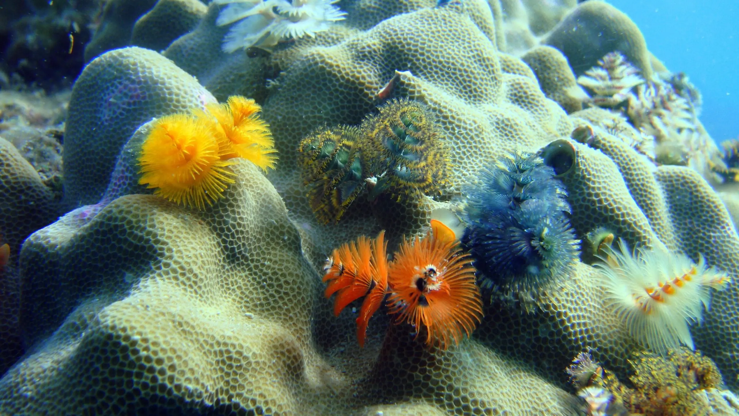
Восстановление деградированных природных экосистем позволяет увеличить площадь мест обитания составляющих их видов, улучшить связность и вернуть полноценное функционирование экосистем.
GSAP SKILLS
Ecological restoration, when implemented effectively and sustainably, contributes to protecting biodiversity, improving human health and wellbeing, increasing food and water security, delivering ecosystem services and economic prosperity, and supporting climate change mitigation, resilience, and adaptation. Combined with conservation and sustainable use of species, ecological restoration can transfer local, regional, and global environmental conditions from a state of degradation to net positive improvement.
Primary tools and resources
Guidelines for rewilding
These guidelines offer both a call for change and general guidance for users. The following five guidelines, adapted from the ten guiding principles for rewilding (Carver et al., 2021), provide a foundation for understanding and taking action to prevent further losses in nature, promote the recovery of biodiversity, and support the restoration of ecological integrity.
Connectivity 101: Ecological connectivity for people and planet
Connectivity 101 is a free, self-paced course provided by the Wildlife Connect Initiative – a partnership of the World Wide Fund for Nature (WWF), Center for Large Landscape Conservation (CLLC), IUCN World Commission on Protected Areas – Connectivity Conservation Specialist Group (CCSG), and Convention on Migratory Species (CMS), designed with UNDP’s Learning for Nature.
Connectivity 101 teaches the basics of ecological connectivity conservation. The course will present general and replicable best practices for connectivity conservation and context-sensitive case studies worldwide. The course will focus on an audience of conservation practitioners but will also be accessible to a general audience. A certificate will be awarded to those who complete the course. Currently, the course is offered in English. Translations to other UN languages may be available in the future.
The CBD Ecosystem Approach (EA)
The Convention on Biological Diversity’s Ecosystem Approach is a strategy for the integrated management of land, water, and living resources to promote conservation and sustainable use in an equitable way. It is the primary framework for such action under the CBD and it contains 12 core principles. The Ecosystem Approach Sourcebook contains a Beginner’s Guide, Advanced Guide, Tools and resources, a Case Study Database, and Operational guidance for applying the 12 principles of the Ecosystem Approach.
How to use
To access the EA Sourcebook and operational guides: https://www.cbd.int/ecosystem/
To download and subscribe to the CBD Ecosystem Newsletter: https://www.cbd.int/ecosystem/ea-newsletters/
Framework for Ecosystem Restoration Monitoring (FERM)
The FERM framework was developed by FAO to support countries in reporting areas under restoration for Target 2 of the Kunming-Montreal Global Biodiversity Framework. It is the official monitoring platform for tracking global progress and sharing good practice for the UN Decade on Ecosystem Restoration. It includes the FERM Guidance which provides information, a geospatial platform, and a registry of restoration initiatives.
International Principles & Standards for the Practice of Ecological Restoration
These principles were developed by the FAO, IUCN Commission on Ecosystem Management, and the Society for Ecological Restoration to support implementation of the UN Decade on Ecosystem Restoration. The second edition of was produced by the Society Ecological Restoration in 2019. These Standards provide a guide for everyone involved in restoring degraded ecosystems — whether terrestrial, freshwater, coastal, or marine. They present a robust framework for restoration projects including effective design and implementation. The Standards support development of ecological restoration plans, contracts, consent conditions, and monitoring and auditing criteria. The Standards establish eight principles that underpin ecological restoration and recommend performance measures for restoration activities for industries, communities, and governments to consider. The second edition also includes an expanded glossary of restoration terminology.
UN Decade on Ecosystem Restoration 2021-2030
The UN Decade on Ecosystem Restoration 2021-2030 is a global call to action, drawing together political support, scientific research, and finance to massively scale up restoration of terrestrial, coastal, and marine ecosystems. It is led by the United Nations Environment Programme (UNEP) and the Food and Agriculture Organization of the United Nations (FAO), working with other partners. The website contains a, social media cards, sample messaging, and an animated visual identity designed for users to use or modify according to their needs.
How to use
To obtain information: https://www.decadeonrestoration.org/charting-course-global-restoration
To contribute to the UN Decade: https://www.decadeonrestoration.org/join-movement
The IUCN Restoration Barometer
The IUCN Restoration Barometer is designed for use by countries that have committed to restore landscapes under international goals or agreements. It is used by governments to track the progress of restoration targets across all terrestrial ecosystems including coastal and inland waters. The Barometer allows governments to simplify and streamline reporting on their restoration commitments and it to track and record progress towards global goals, including The Bonn Challenge, the 30×30 target under the Post-2020 GBF, the Paris Agreement, and the Land Degradation Neutrality Target. Ecosystem restoration interventions are classified according to the IUCN Restoration Intervention Typology for Terrestrial Ecosystems (RITTE) and categorization of ecosystems by the UN Decade on Ecosystem Restoration. The Barometer has eight indicators and records the size of the area being brought under restoration as well as the corresponding climate, biodiversity, and socio-economic benefits. Currently, only government focal points can create accounts on the Barometer website. New users can request an account and after verification, restoration related data can be entered securely. A set of simple tutorials is provided to assist the process.
Species Threat Abatement and Restoration (STAR) metric
The STAR metric assesses the potential of particular actions at a specific location to contribute to reduce species extinction risk / global targets for species. It measures the potential contribution of two kinds of action: threat abatement / reduction and habitat restoration using data on the distribution, threats, and extinction risk of threatened species contained in the IUCN Red List. It helps governments, the finance industry, investors, and companies to target their investments and activities to achieve conservation outcomes for threatened species. The STAR metric can be applied to any location. It is maintained under the authority of the IUCN Red List Committee.
IUCN Guidelines for conserving connectivity through ecological networks and corridors
Connectivity conservation is essential for managing healthy ecosystems, conserving biodiversity and adapting to climate change across all biomes and spatial scales. Well-connected ecosystems support a diversity of ecological functions such as migration, hydrology, nutrient cycling, pollination, seed dispersal, food security, climate resilience and disease resistance. These Guidelines are based on the best available science and practice for maintaining, enhancing and restoring ecological connectivity among and between protected areas, other effective areas based conservation measures (OECMs) and other intact ecosystems. For the first time, this publication introduces a common definition and recommends formal recognition of ecological corridors to serve as critical building blocks of ecological networks in conjunction with protected areas and OECMs. Furthermore, these Guidelines also include 25 case studies that demonstrate current approaches to conserving ecological connectivity and ecological networks for different ecosystems and species, and at different spatial and temporal scales.
Guidelines for the application of IUCN Red List of Ecosystems categories and criteria
The IUCN Red List of Ecosystems is a global framework for monitoring the status of ecosystems. It is part of the growing toolbox for assessing risks to biodiversity and aims to support conservation, resource use, and management decisions by identifying ecosystems most at risk of biodiversity loss. The basis of the IUCN Red List of Ecosystems is the IUCN Red List of Ecosystems Categories and Criteria, a set of eight categories and five criteria that provide a consistent method for assessing the risk of ecosystem collapse. These Guidelines assist correct implementation of the IUCN Red List of Ecosystems Categories and Criteria by providing information on the development of the protocol and a detailed overview of the scientific foundations supporting the categories and criteria.
Other tools and resources
Kelp Blue
Kelp Blue is a commecial entitiy founded by Daniel Hooft in February 2020. Its business headquarters are in Zeist, The Netherlands. It has a subsidiary in Namibia with operational headquarters in Luderitz, Nambibia. At the moment it employs 12 full time employees, 5 part-time employees and 4 interns. The gender balance is 50% female, 50% male. Its mission is “to rewild the oceans by cultivating giant kelp forests”
Kelp Blue focused first on its MISSION. Next we needed to find FUNDING. We obtained in-pinciple funding from Climate Investor Two and Eos Capital for USD $60million.
At the same time we have built a strong competent multi-disciplinary TEAM with deep experience in multiple industries. Each of us brings our own learnings and unique skills to the table; this means we can take advantage of different perspectives and best practices as we look to grow Kelp Blue.
Always focus on your mission – it will dictate all of the decisions you from whom you employ, the selection of suppliers and even your processing techniques.
Having stong funding partners with the same vision is key.
Don’t underestimate the time and energy fundraising takes, start at least 6 months before you really need the funds.
Réhabilitation des terres par le reboisement – le pouvoir des droits de propriété dans la chaîne de valeur du bois-énergie vert
Répondre à la demande croissante en bois-énergie est un défi et un facteur de déforestation et de dégradation des forêts. La Restauration des Paysages Forestiers (RPF) et les engagements des pays envers l’AFR100 s’adressent ainsi à la production durable de bois-énergie afin de répondre aux réalités sociales et économiques.
La chaîne de valeur bois-énergie, en s’adressant à toutes les parties prenantes, encourage les petits entrepreneurs. L’approche combine des éléments juridiques, de gouvernance, économiques et techniques depuis les transferts des titres fonciers et des plans de reforestation individuels sur des terres dégradées au niveau villageois jusqu’à la récolte, traitement, transformation, distribution et commercialisation par les consommateurs finaux de bois-énergie ainsi que les technologies de combustion associées (foyers améliorés).
Elle modernise la chaîne de valeur du bois-énergie et génère des bénéfices pour les intervenants. Leurs revenus annuels ont doublé en moyenne.
Gestion artificielle d’espèces végétales pionnières en contexte forestier : aux antipodes de la dynamique naturelle.
La réserve biologique dirigée (RBD) du Hochfeld a pour enjeu principal la conservation d’une exceptionnelle population de lycopodes (6 taxons). Au sein d’une forêt dense de hêtre, un aménagement réalisé dans les années 1960 a occasionné un déboisement et même un décapage du sol. Cette atteinte à la forêt a été suivie de la reconstitution spontanée d’une lande pionnière à éricacées très rase, qui a permis l’apparition des lycopodes. Les conditions n’auraient pas pu être aussi favorables dans le cas d’une coupe forestière, moins traumatisante pour le milieu et qui aurait été suivie d’une reconstitution rapide du peuplement, sans véritable interruption de la végétation forestière.
Il n’y a pas d’historique pastoral dans la RBD du Hochfeld, et le bétail risquerait de toute façon d’occasionner trop de dégâts aux lycopodes. On se trouve dans une situation où l’entretien de la lande se fait donc nécessairement par la combinaison de la mécanisation et d’interventions manuelles.
Des engagements internationaux à la mise en œuvre locale – la restauration des paysages forestiers à Madagascar
Le bien-être des habitants de Madagascar dépend de ses ressources naturelles et de ses services, tels que le bois de feu, la nourriture et l’eau. De nombreuses zones sont dégradées dues à l’utilisation non durable des terres. Les aléas climatiques ajoutent plus de risques pour les personnes, la nature et l’économie. La restauration des paysages forestiers (RPF) est une priorité clé de l’AFR100 pour assurer un développement durable. Les écosystèmes résilients améliorant l’économie, la sécurité alimentaire et l’approvisionnement en eau, la conservation et la séquestration du carbone en sont les piliers. Cette solution couvre la mise en place de plateformes multiséctorielles , les mesures de renforcement des capacités des acteurs, le développement d’une stratégie nationale RPF et la priorisation des payasages à restaurer basées sur une évaluation multicritère. Les prochaines étapes consisteront à identifier des sites pour piloter des activités de restauration dans la région Boeny.
Restauration des Paysages Forestiers et mise en valeur du terroir villageois de Mogazang au Cameroun
La désertification et ses conséquences menacent le bien-être de la population du nord du Cameroun, en particulier des ménages ruraux. Le manque de feu de bois et bois de construction, et l’extrême pauvreté sont des défis majeurs pour la population de Mogazang. Les aléas climatiques comme la modification des régimes de précipitations exacerbent aussi risques pour la population. L’élaboration d’une carte par les membres de la communauté a permis la démarcation d’un terrain dégradé (10,74 ha) à restaurer. En adoptant une approche «d’apprentissage par la pratique», différentes techniques de restauration de la fertilité des sols ont été testées. En attendant que la parcelle soit productive, les femmes ont été formées à des activités alternatives génératrices de revenus et à la construction de foyers améliorés. L’initiative contribue ainsi aux objectifs de l’AFR100 par la restauration des terres dégradées, la réduction de la pression sur les ressources naturelles et la génération de revenus.
Siembra y cosecha de agua de lluvia frente a la sequía en cabecera de cuencas Cachi-Mantaro y Pampas
Siembra y cosecha de agua de lluvia (SCALL), es un modelo hidrológico campesino cuyo enfoque es la crianza del agua de lluvia en el marco de la cosmovisión local. Es una práctica colectiva como respuesta a la creciente escasez de agua. La experiencia combina la infraestructura verde con prácticas culturales, sociales y ambientales. Los beneficios: formación de humedales, recarga de manantiales, fortalecimiento de la relación con la naturaleza, valoración cultural y una perspectiva de servicio ecosistémico a la ciudad de Huamanga.
Carne del Monte fomenta la ganadería sustentable en México
Neek ’Capital es un company builder que nació en el 2017 con la misión de crear compañías mexicanas nuevas con potencial de crecimiento, dedicadas a la implementación del uso sustentable de la energía, el agua, los sistemas alimenticios y la biodiversidad a grande escala. El objetivo era crear empresas destinadas a resolver los desafíos planteados por el uso sustentable de los recursos naturales en un mundo con restricciones climáticas.
A través de nuestras operaciones de producción, procesamiento y comercialización, buscamos la regeneración del campo como fuente sustentable de proteína animal de alta calidad e invertir directamente en la restauración de la selva Yucateca.
Buscamos ser un ejemplo de sustentabilidad mediante el uso de sistemas productivos regenerativos que se mantengan en el largo plazo, mejorando así los ingresos de los productores y la calidad agroecológica de sus ranchos ganaderos.
Restauración ecológica en la Zona de Amortiguamiento del Parque Nacional Cordillera Azul
El proyecto Restauración Cordillera Azul viene impulsando procesos de restauración ecológica en los poblados de San Juan y Lejía en la región San Martín desde el 2018, en 50 hectáreas que conectan con un paisaje de 500 ha, en la Zona de Amortiguamiento del Parque Nacional Cordillera Azul (PNCAZ). Para ello CIMA (organización que ejecuta el contrato de administración del PNCAZ) ha suscrito un convenio de cooperación entre la Universidad Nacional Agraria de la Selva, el caserío de San Juan y el centro poblado de Lejía. Las comunidades tienen Acuerdos Azules de colaboración, como estrategia participativa de planificación territorial y de los Planes de Calidad de Vida.
How a real estate project can ensure longterm financing for the conservation of a wilderness area
Through a real estate project “Reserva Ecologica Oasis de la Campana” it is possible to protect 1000 hectares of sclerophyllous forest of Mediterranean ecosystem. The project destines a sector that is subdivided into properties of 0.5 hectares for real estate purposes and another sector of 1000 hectares to conservation of Mediterranean forest and its biodiversity. Through the legal framework of reciprocal environmental easements between the parcels of the real estate sector and the area destined for conservation and the delivery of these lands to a non-profit Foundation, the legal protection in perpetuity of the 1000 hectares is ensured. On the other hand, this same legal framework ensures that the common expenses of the owners of the real estate subdivision finance not only the maintenance of their common areas but also the maintenance activities of the wilderness area to be conserved. This includes protection and restoration activities.
Desarrollo sostenible, adaptación al cambio climático y OMEC en zona buffer del Parque Nacional Tamá
El PNN Tamá es una estrella hídrica que abastece sectores productivos y comunidades de varios Departamentos al nororiente de Colombia y Estados al occidente de Venezuela. La falta desarrollo local, el conflicto armado, así como el cambio climático y la variabilidad climática han generado presiones frente al uso del suelo en la zona aledaña del PNN Tamá. Como solución, desde Parques Nacionales Naturales de Colombia innovamos la producción local sostenible de sistemas agrofroestales de café, el monitoreo participativo de recurso hídrico y las alianzas para la gestión de recursos, con lo cual se han fortalecido las inversiones y procesos de relacionamiento con actores estratégicos en favor de la conservación de los servicios ecosistémicos que brinda el Parque. Adicionalmente, hemos apoyado la declaratoria de Reservas Naturales de la Sociedad Civil, rodeando y protegiendo al PNN Tamá con áreas protegidas privadas manejadas por las comunidades.
A Partnership with the Wine Industry to Sustain Protected Areas and Ecosystem Services in Chile
A través de investigación cientifica relevante y procesos de colaboración ciencia-productor, se contribuye a la identificacion y creación de áreas de conservacion privadas en predios agrícolas, integran el rediseño de predios y su manejo para que coexistan con la biodiversidad. Este trabajo es Realizado por el Programa Vino, Cambio Climatico y Biodiversidad con el apoyo de 21viñas Chilenas desde el año 2008.
Siembra y cosecha de agua de lluvia frente a la sequía en la Microcuenca de Huacrahuacho
Esta solución se implementó en la microcuenca Huacrahuacho, ubicada en un ecosistema altoandino llamado Puna sobre los 3.800 msnm. Se diseñó frente a los problemas de sequía y disminución de fuentes de agua, durante la época seca, para el consumo humano y el uso agropecuario. Tuvo como objetivos: captar, almacenar e infiltrar agua y recargar los acuíferos; incrementar/mantener el caudal de los manantiales; generar un microclima con mayor humedad; y conservar la biodiversidad.
La qocha, palabra quechua que significa laguna pequeña, fue el centro de un conjunto de medidas que incorporan forestación, zanjas de infiltración, manejo de pasturas naturales y acequias colectoras o aductoras.
Gracias a estas medidas construidas por las familias y a nivel comunal, se cuenta con más agua durante las épocas de estiaje, lo que ha permitido la recuperación de pastos naturales para la producción ganadera y un cambio hacia un paisaje más húmedo con mayor biodiversidad y belleza paisajística.
Solutions and case studies
Natural measures for ecological Gradac
The Public Water Management Company “Srbijavode”, in cooperation with the protected area manager “Ecological Society Gradac” achieved significant ecological restoration and educational outreach in the Gradac River area. The project involved riverbed clearing by mechanically removing obstacles to river flow, such as large fallen tree trunks, stumps and over 3,500 m³ of sediment, to enhance river flow and restore ecological balance. PWC “Srbijavode” implemented bioengineering interventions by installing willow-wattle structures to provide a nature-based solution for preventing riverbank erosion along a pilot area of 150 m. Throughout the project, scientists from the Institute for Biological Research “Siniša Stanković” conducted biodiversity assessments to ensure minimal negative impact on the ecosystem and to highlight the Gradac River’s good water quality. The Ecological Society Gradac engaged with over 250 primary school students in the Valjevo area through educational workshops.
Green Pastures for Green Transition
The project focuses on restoring grassland habitats in the Special Nature Reserve (SNR) Kraljevac by providing the local community with thirty sheep, a solar powered shepherd’s hut and an electrical fence which shall all be used for controlled grazing over 16.5 hectares to prevent habitat succession and support species like the endangered European ground squirrel. Two hectares along Lake Kraljevac have been afforested with native trees such as pedunculate oak, white willow, and poplar. A monitoring system for the European ground squirrel population has been established in order to define the ecological corridors for the species.
Apart from creating favorable conditions for a stable European ground squirrel population, the provision of 30 autochthonous sheep benefits the local community, the local shepherds in particular, and ensures the involvement of the local community in the sustainable management of the critical grassland habitat, whilst enhancing public awareness of the importance of grassland ecosystem conservatio
Local voices, sustainable forests: Participatory landscape restoration
In many African countries, agricultural growth remains a key driver of development. Agriculture ensures food security and is a source of rural income and employment. However, most small farms suffer from low productivity due to soil degradation, a lack of inputs and knowledge of sustainable agricultural practices, and the effects of climate change.
In Côte d’Ivoire, these challenges are amplified by deforestation: forest cover has fallen from around 16 million hectares in the 1960s to 2.5 million today, weakening ecosystems and soil fertility while increasing rural vulnerability.
The Participatory Household-Level Restoration Plan (PPR) offers an inclusive approach where each household aligns its vision, needs, and priorities with forest restoration. By placing rural families at the heart of planning, implementation, and monitoring, the PPR promotes sustainable restoration.
Diverse Culture Based on the Satoyama Initiative of Shuanglianpi Pond (Yilan, Taiwan)
The Shuanglianpi Settlement, located in the mountains of Yilan, is named after Shuanglianpi Pond. Known for once hosting a third of Taiwan’s native aquatic plant species, the area was designated as the “Yilan County Shuanglianpi WildlifeRefuge” in 2003 to protect its freshwater plants.
This designation and land expropriation led to longstanding conflicts among residents, public
sectors, and externalgroups. In 2018, the Yilan Branch of the Forestry and Nature Conservation Agency began interviewing local elders and residents, uncovering a shared memory: the damaged century- old irrigation canal. Most residents expressed support for restoring the canal torebuild relationships, foster communication, and establish a partnership basedon mutual support. To advance sustainable development, the Branch invited local partners to join resilience
assessment workshops (RAWs) in 2022 to identify priorities and formedan interdepartmental platform for ongoing adaptive co-management of Shuanglianpi.
Integrated river restoration and community stewardship to protect the Critically Endangered Tradouw Redfin
This Solution applies integrated river restoration and community stewardship to reduce key threats to the Critically Endangered Tradouw Redfin in the Huis River, South Africa. It combines invasive alien plant clearing, targeted riparian restoration, water-saving measures and community awareness to improve habitat quality and river resilience.
The approach addresses habitat degradation, invasive vegetation, water pressure and limited local awareness. By restoring riparian structure and coordinating action through a multi-agency Tradouw Redfin Working Group, the project improved river health indicators, restored critical habitat and strengthened long-term protection for the species through a formal Species Action Plan.
Building community-led restoration capacity through an operational indigenous plant nursery
This Solution centres on establishing an operational indigenous plant nursery as part of an active restoration programme in the Grootvadersbosch landscape, South Africa. The nursery is used not only to propagate locally appropriate indigenous plants, but also as a practical training hub for community members involved in restoration.
The approach addresses key challenges including invasive alien plants, degraded riparian and forest-edge habitats, limited local restoration skills, and shortages of suitable planting material. By integrating training with hands-on nursery work and field implementation, the project has produced thousands of indigenous plants, restored degraded sites, and built lasting restoration capacity within the local community.
Integrated river restoration and community stewardship to protect the Critically Endangered Tradouw Redfin
This Solution applies integrated river restoration and community stewardship to reduce key threats to the Critically Endangered Tradouw Redfin in the Huis River, South Africa. It combines invasive alien plant clearing, targeted riparian restoration, water-saving measures and community awareness to improve habitat quality and river resilience.
The approach addresses habitat degradation, invasive vegetation, water pressure and limited local awareness. By restoring riparian structure and coordinating action through a multi-agency Tradouw Redfin Working Group, the project improved river health indicators, restored critical habitat and strengthened long-term protection for the species through a formal Species Action Plan.
The new guardians of the páramo: Voluntary Agreements that transform the practices of farming families.
Chingaza National Park, with more than 77,000 hectares, is one of the most strategic protected areas of the Colombian National Natural Park System, as it is the main source of drinking water for 10 million people in the Bogotá DC and surrounding municipalities. It also protects moorland and Andean forest ecosystems that are key to regulating water resources in the Orinoco macro-basin, conserves endemic and/or nationally and globally threatened species of fauna and flora, and safeguards important sites for the indigenous communities that inhabited the territory. To guarantee its protection, the park has established conservation agreements with peasant families as part of a conservation pact. This participatory strategy allows communities to improve their productive practices while guaranteeing the protection of key ecosystems for the provision of ecosystem services, achieving a local collective effort that guarantees water security for future generations.
Cross-Sectoral Exchange For Improved Management Of Natural Resources In Rwanda
The Cross-Sector Taskforce (CSTF) was established in 2015 to coordinate Rwanda’s response to the Bonn Challenge and enhance Forest Landscape Restoration (FLR) efforts. Comprising 35 member organizations, including government bodies, NGOs, private sector actors, and research institutions, the CSTF fosters collaboration, shares technical knowledge, and harmonizes FLR monitoring systems. It provides a platform for addressing deforestation, land degradation, and biodiversity loss while aligning restoration efforts with national and international strategies like the Green Growth and Climate Resilience Strategy (GGCRS), AFR100, and the Paris Agreement. Recent meetings have focused on integrating FLR with sustainable food systems, improving monitoring tools, and incentivizing local farmers. By facilitating knowledge exchange and improving governance, the CSTF enhances restoration efforts and strengthens Rwanda’s ability to meet its target of restoring 2 million hectares of land by 2030.
First Payment for Environmental Services Scheme in Cuba: Promoting carbon removal through sustainable forest management
Cuba’s geological evolution, climate, and insular geography led to highly diverse ecosystems with various endemic species. Nonetheless, declining forest cover and climate change hazards have threatened the country’s rich biodiversity. Moreover, CO2 emissions accelerate the impacts of climate change on ecosystems, in addition to harming human well-being.
To address these challenges, the Cuban government, with support from the Biodiversity Finance Initiative (BIOFIN) of the United Nations Development Programme (UNDP) and the Ecovalor project, established a payment for environmental services scheme that rewards carbon removal through sustainable forest management.
By March 2025, the scheme disbursed USD 238,000 (CUP 5,709,066) in payment for environmental services, associated with the removal of 999,473 tons of carbon across 12,646 hectares of forest. This initiative contributes to climate mitigation, ecosystem conservation, and the responsible use of natural resources in Cuba.
Embedding Integrated Water Resources Management in Rwanda’s Sebeya Catchment
The Sebeya catchment in Western Rwanda, once prone to recurrent flooding, erosion, and landslides, was transformed through the “Embedding Integrated Water Resources Management in Rwanda (EWMR)” project. Led by Rwanda Water Resources Board and partners, the project applied Nature-based Solutions (NbS) to restore 7,700 hectares using terraces, trenches, riverbank protections, and afforestation. The approach combined land rehabilitation with innovative financing, value chains, and inclusive planning. Over 35,000 green jobs were created, alongside improved soil health, aquifer recharge, agricultural productivity, and livelihoods. By integrating community-driven land use planning into district-level governance, the project laid the foundation for long-term resilience and scalability.
Jabal Shada Protected Area – Where Nature and Communities Thrive Together
Jabal Shada is an isolated twin-mountain granite massif with spectacular scenery characterized by jagged spires, pinnacles, and traditional agricultural terraces. Located in the Al-Baha region in southwestern Saudi Arabia, it supports exceptionally rich floral diversity (nearly 493 recorded plant species) and traditionally important highland crops notably Shadawi coffee. The mountain is both an ecologically isolated element and a cultural landscape. It was declared as a protected area in year 2002 to secure unique biodiversity while supporting local livelihoods and providing nature-based tourism opportunities. Recent management planning emphasizes biodiversity monitoring, community partnerships (including agricultural support and farm-experience tourism), and identification of hiking/ecotourism trails to deliver conservation and socio-economic benefits.
