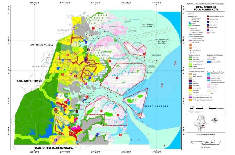
Implementation of Integrated Coastal and Marine Spatial Planning of Bontang
The new integrated spatial plan of Bontang City has been adopted by the local parliament in 2012 and is being implemented in parts. It now includes both land and marine areas with its mangroves, coral reefs and seagrass beds located within four miles from the shoreline. It is the first example of the implementation of the Indonesian Law No 26/2007 on Spatial Planning and Law No 27/2007 on Coastal Area and Small Islands Management to be applied in coastal districts/cities in Indonesia.

